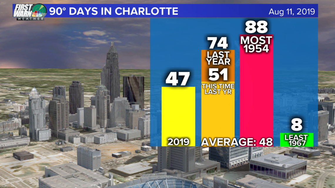
CHARLOTTE, N.C. — Sunday was the 6th day in a row at 90°+ but the following three days will be more humid rising our heat indices and how hot you feel! This was the 47th time we have hit 90°, tying us for the 17th most 90° days up to August 11.
We are keeping pace with last year which had a total of 74 days at 90° (the 9th most all-time for Charlotte).


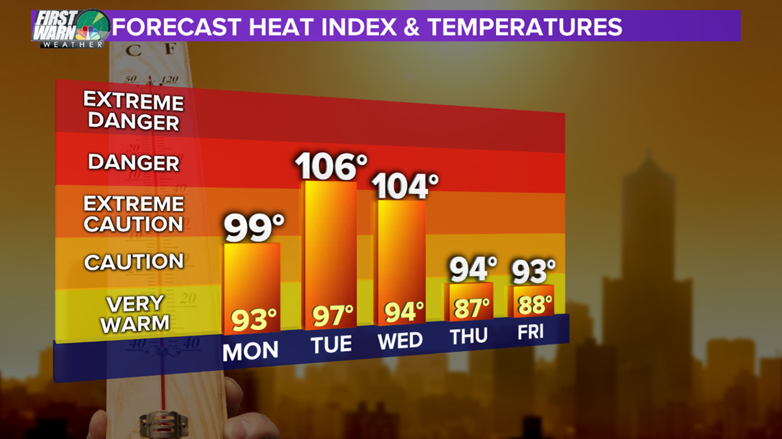
This next three-day stretch will not be anything record-breaking but just oppressively humid and highs hovering around the mid 90's. Tuesday, for now, will be the hottest. We would need to hit 98°+ to tie or surpass the warmest temperature of 2019.
There is still a chance these temps could be 1-3° cooler depending on our rain coverage of developing thunderstorms and also cloud cover that will be partly cloudy to partly sunny status the next few days.


When dew points are below 60°, it feels great. When they are from 60-69°, it is humid. Above 70° dew points creates that air you can wear and it makes you feel A LOT hotter.
The reason for this is that when it is overly humid, your sweat evaporates much slower. Evaporation is a cooling process so if this is reduced, you will feel hotter than the actual temperature.


Tuesday and Wednesday, for now, have the best shot at a range of heat indices from 100-105°. Tuesday will likely have a Heat Advisory in place due to this. Wednesday still could be cooler due to a better chance at widespread rain. After Wednesday we see no break from the mugginess but will have highs return to around normal (88°).

