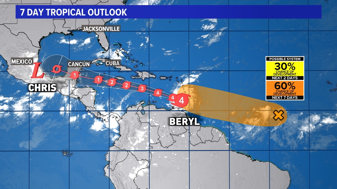
JACKSONVILLE, Fla. — Hurricane Beryl made landfall as an extremely dangerous Category 4 storm on the Caribbean island of Carriacou (Grenada) Monday morning. It has sustained winds of 150 mph, which makes it an strong Category 4 hurricane. It is bringing catastrophic winds and life-threatening storm surge along the southern Windward Islands.

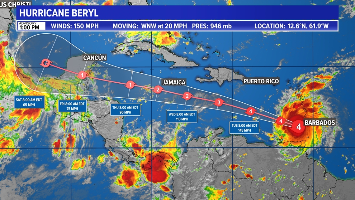
Hurricane-force winds extend outward up to 40 miles from the center and tropical-storm-force winds extend outward up to 125 miles. It is moving toward the WNW near 20 mph.
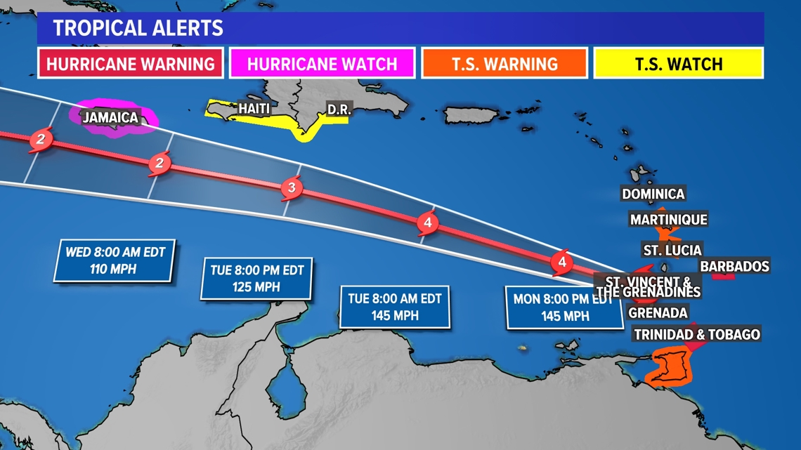
A Hurricane Warning is in effect for Barbados, St. Vincent and the Grenadine Islands, Grenada and Tobago. A Hurricane Watch is in effect for Jamaica. A Tropical Storm Warning is in effect for Martinique, Trinidad and St. Lucia. A Tropical Storm Watch is in effect for the south coast of Dominican Republic from Punta Palenque westward to the border with Haiti, and the south coast of Haiti from the border with the Dominican Republic to Anse d'Hainault.

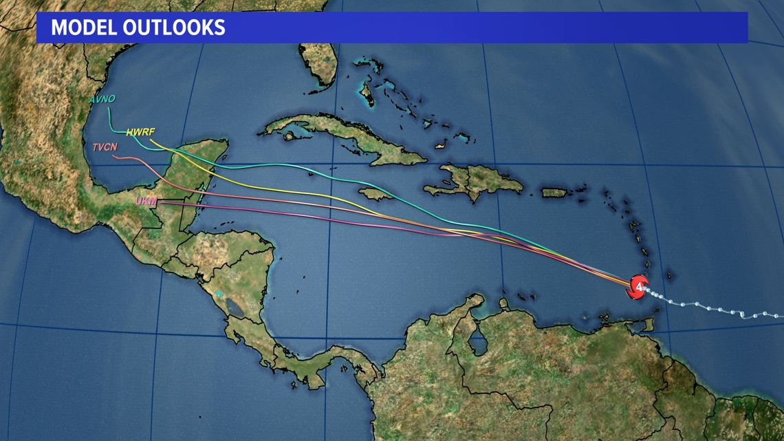
Beryl will then head across the southeastern and central Caribbean Sea late Monday through Wednesday. There is still plenty of uncertainty in the long-range forecast.

Record Breaking:
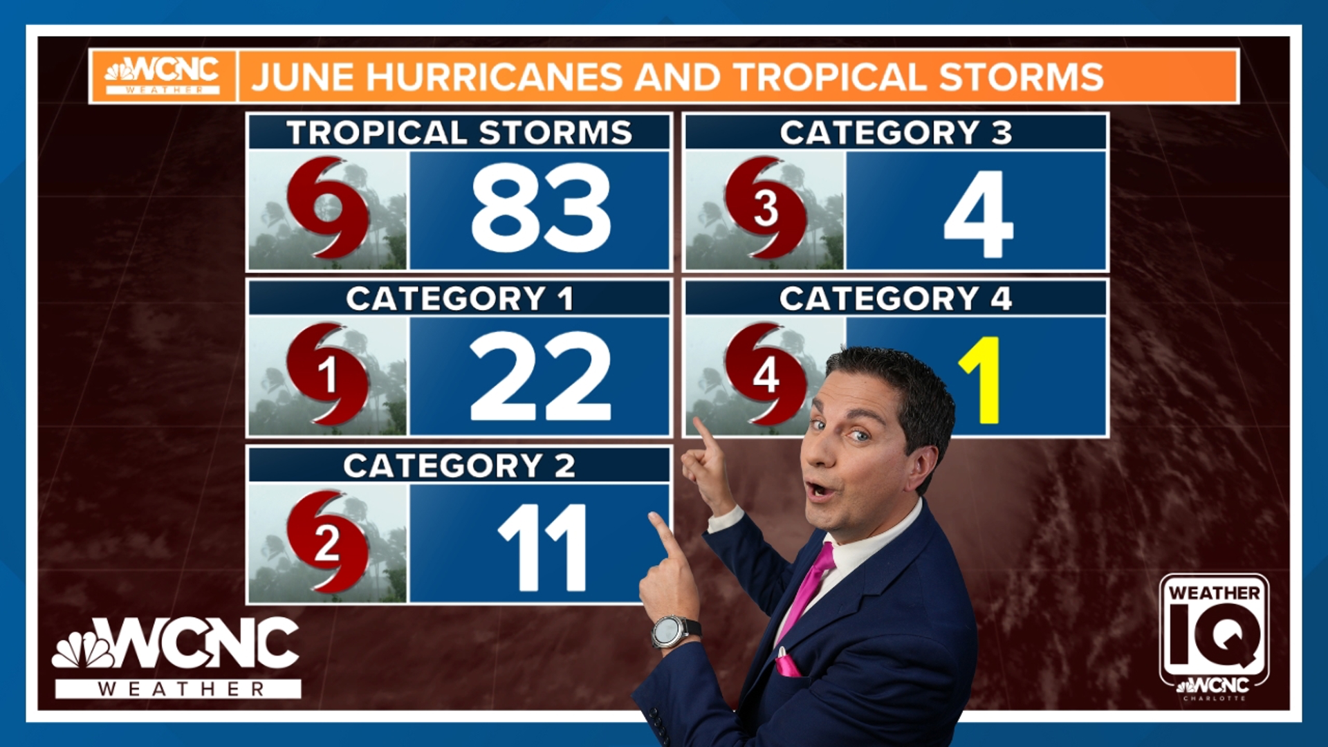
Beryl strengthened into a Category 4 hurricane Sunday, making it the earliest Category 4 hurricane on record in the Atlantic basin. This storm is not an immediate threat to the First Coast.
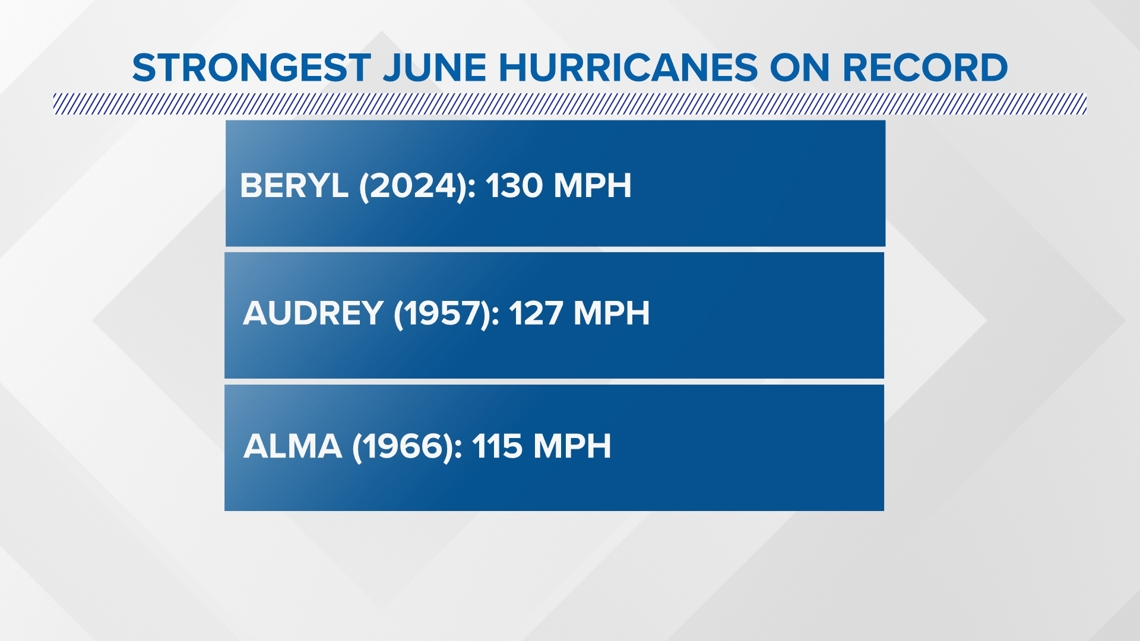
This is the strongest hurricane ever in the month of June in the Atlantic. It is also the first major hurricane in June since Alma in 1966.

Beryl is also the eastern-most June hurricane on record.
Beryl rapidly intensified from a tropical storm to major hurricane in just 42 hours. This has happened only 6 other times in our recorded history, all of which occurred in the month of September. Warmer than normal waters are fueling the hurricane, with current water temperatures as hot as what's typical for September.
The Tropics are extremely active. For more information on all tropical systems the NHC is watching, read our Talkin' Tropics story.

