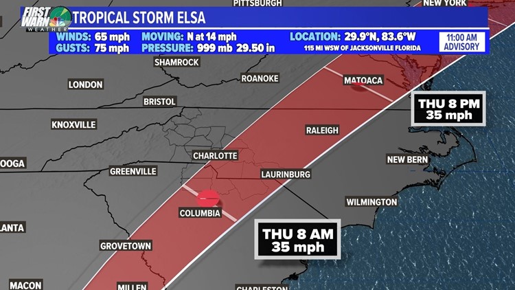
CHARLOTTE, N.C. — Tropical Storm Elsa made landfall in Florida's Big Bend region Wednesday morning with 65 mph winds and heavy rain battering the state.
As of 2 p.m. Wednesday, Elsa continues to weaken with sustained winds of 50 mph. The storm is still moving north at 14 mph and is located about 105 miles west of Jacksonville, Florida. The National Weather Service has discounted all warnings south of the Suwannee River in Florida. A Tropical Storm Warning is in effect from the mouth of the St. Mary's River to Little River Inlet, South Carolina.
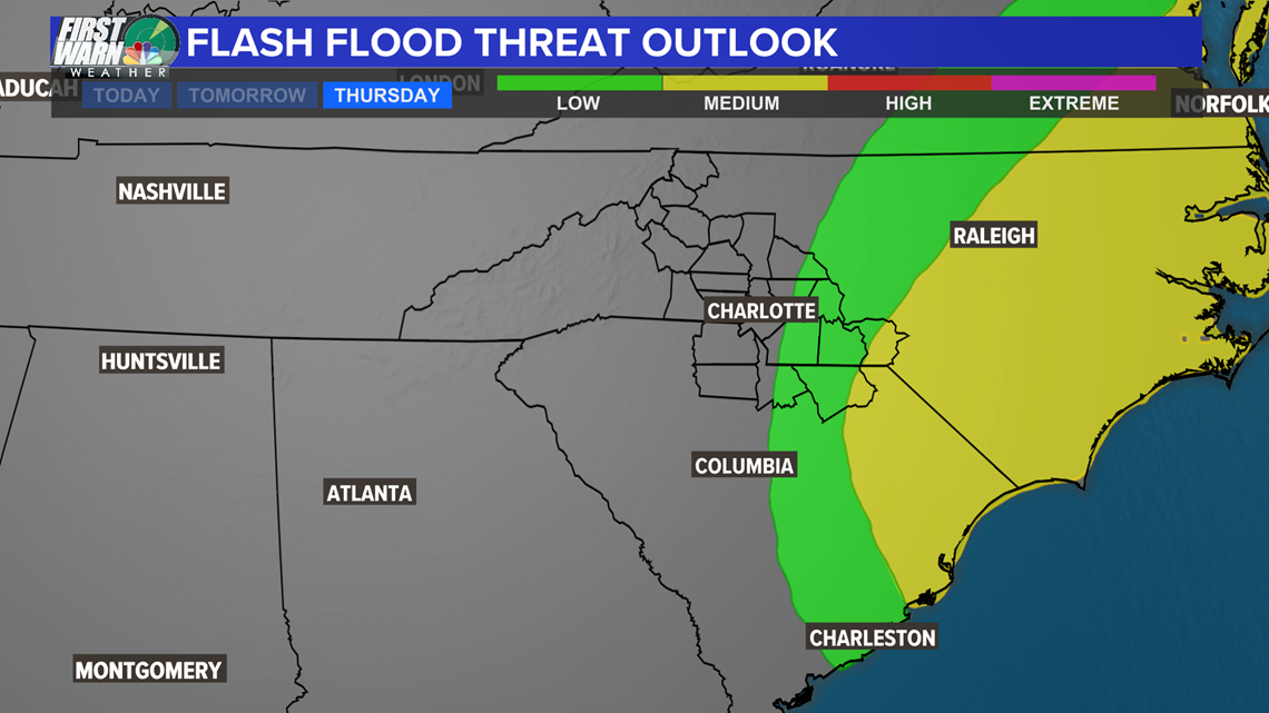
The National Weather Service has issued a Flash Flood Watch for many counties in central North Carolina. Counties in the Charlotte area under a Flash Flood Watch until Thursday afternoon include Anson, Richmond and Stanly. Up to 3" of rain is possible in these areas from Elsa as the storm moves across the Carolinas Wednesday night into Thursday.
North Carolina cities and towns under the Flash Flood Watch include Asheboro, Rockingham, Ellerbe, Wadesboro, Albemarle, Raleigh, Winston-Salem, Fayetteville and Greensboro.
Florida Gov. Ron DeSantis urged people in the area to take caution and stay out of the storm.
"We ask that you please take it seriously," DeSantis said Tuesday. "This is not a time to joyride because we do have hazardous conditions out there."
Chief Meteorologist Brad Panovich said the storm will move into the Carolinas late Wednesday night into Thursday morning as a tropical depression. The storm's quick movement will reduce the flooding risk but up to 3" of rain is possible in areas south and east of Charlotte, North Carolina.

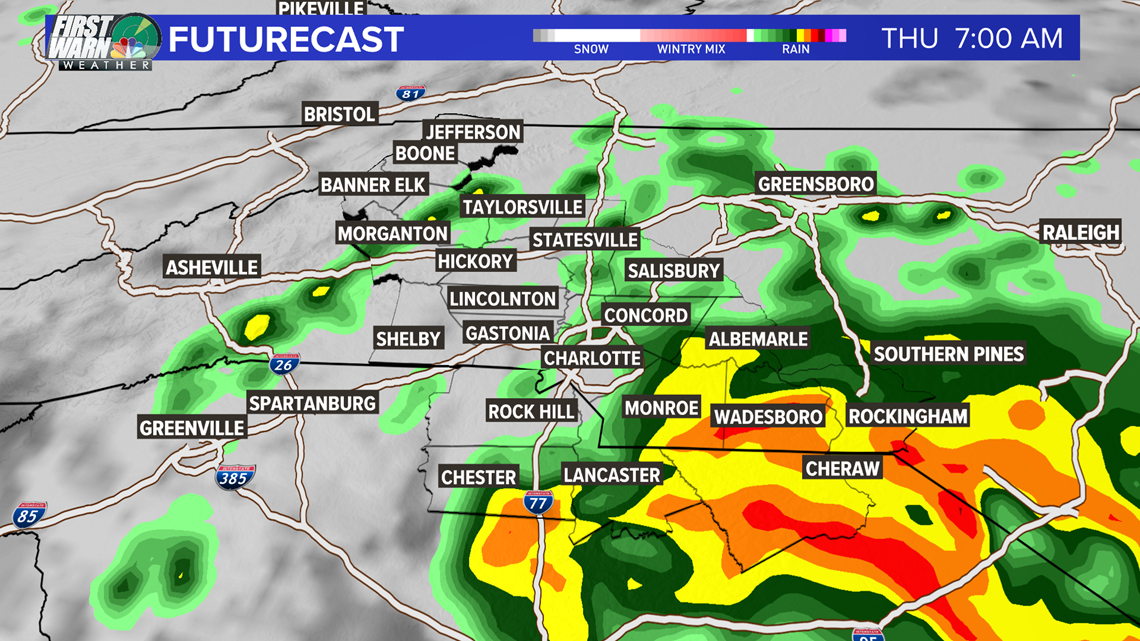
"You'll start to see showers move up north along Interstate 77," First Warn forecaster Larry Sprinkle said. "By 5 a.m., heavy rain will cover the entire area, from Taylorsville to Statesville, down to Charlotte and all the way down to Chester, South Carolina."
By 9 a.m., Sprinkle said the heaviest rain will be north and east of Charlotte and along I-85. Areas like Albemarle, Salisbury and Greensboro will be at risk for the heaviest rain at that time.
Elsa is expected to continue on that northeasterly track before moving into Raleigh Thursday afternoon and eventually to the Atlantic Ocean. Areas along the Carolina coast could see up to 4" of rainfall, with some locations east of Charlotte, including Rockingham and Wadesboro seeing a possibility of 2".
While localized flooding is certainly possible, the risk of flash flooding is low and looks to be contained across our southern and southeastern counties Wednesday and Thursday.

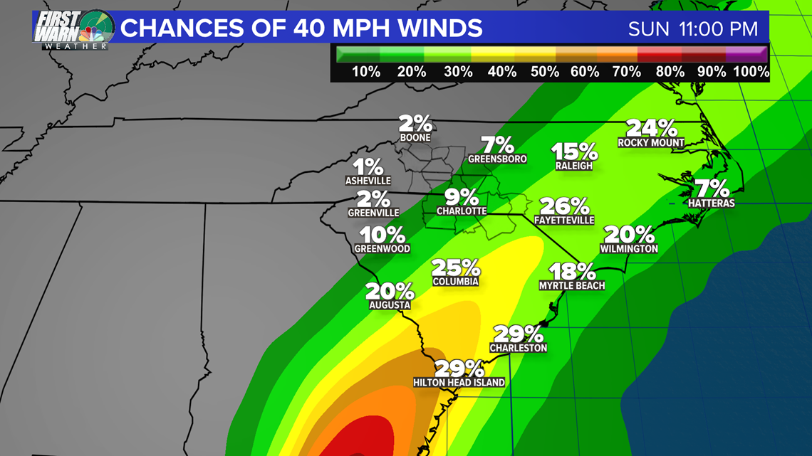
For the most part, Elsa won't be a big issue in Charlotte. While it will be breezy at times across southern and southeastern counties, the chance for tropical-storm-force winds is very low.

Stick with the First Warn Storm Team for the latest on Elsa and its impact on the Carolinas.


