MORGANTON, N.C. — It's not quite raining, nor is it quite snowing, in portions of the Carolinas Friday night.
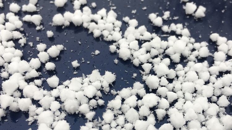
The semi-frozen precipitation falling from the skies in the western North Carolina mountains and foothills is called graupel.
"It's partially melted snowflakes that attracted super cooler water on the way down," Chief Meteorologist Brad Panovich explained.
The winter weather is leaving behind a coating of white on the ground.
Scotty Powell recorded video of the wintry mess in Morganton.
Melissa tweeted Brad this photo from Union Grove.
Home surveillance video in northern Iredell County caught the show as well.
Brad tweeted radar images that showed the showers responsible for the graupel.
Most of the reports of graupel Friday were along or north of Interstate 40.
Elsewhere across the region, reports of fog stretched all along the Interstate 77 corridor - from the state border with Virginia, through North Carolina and South Carolina, and into Georgia (if you imaged Interstate 77 continued south further from Columbia.)
This weekend, the sky in Charlotte will gradually clear as temperatures fall to around freezing by Saturday morning. Charlotte will start off the weekend with plenty of sunshine before a few more clouds roll in for the second half of the day Saturday. Expect highs in the middle 40s, but with winds gusting as high as 20-25 mph, it will feel like the 30s! Snow showers will develop in the Mountains early Saturday where as much as 4-5" could fall for locations above 3500'.


