CHARLOTTE, N.C. — The National Hurricane Center is investigating a tropical disturbance expected to become a tropical storm near the northern Bahamas and eastern Florida.
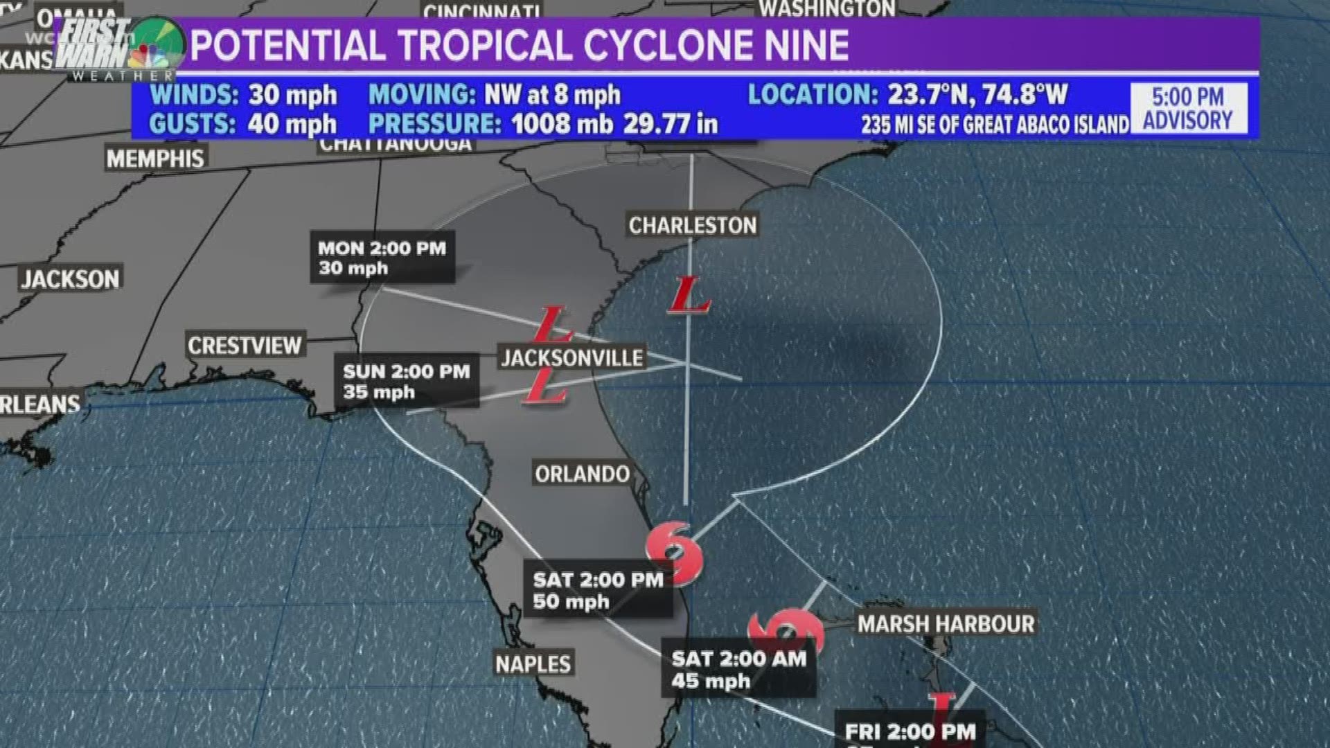
At 5 p.m. Thursday, the National Hurricane Center in Miami began issuing advisories on what is now known as "Potential Tropical Cyclone Nine." It was previously known as "Invest 95-L."
The area of tropical disturbance is currently located in the southeastern Bahamas. A hurricane hunters aircraft is currently flying into the storm to take measurements otherwise not obtainable by ground stations or satellites. Depending on what the meteorologists aboard the plane find, the storm could later be upgraded to a tropical storm.
With sustained winds of only 30 mph - and no developed center eye - the storm is not yet classified as a tropical depression. That upgrade could come as early as Friday morning before intensifying as a tropical storm Saturday.
"On this track, the system is anticipated to move across the northwestern Bahamas on Friday, and along or over the east coast of central Florida on Saturday," the National Hurricane Center said in a released statement.
A tropical storm has sustained winds of at least 39 mph.
Like many September tropical cyclones, the system is moving along a very similar path to Dorian. While rainfall is expected over the Bahamas, storm surge is not expected.
The system is expected to produce total rain accumulations of 2 to 4 inches through Sunday over the Bahamas and along the east coast of Florida north of West Palm Beach. Isolated maximum amounts of 7 inches are possible in the northwest and central Bahamas.
Much like Dorian, the storm could brush the east coast of Florida before turning north towards the coasts of Georgia and South Carolina. Unlike Dorian, the current forecast from the National Hurricane Center does not have it developing into a hurricane.
If the storm stays on its current forecast track, tropical-storm force winds could arrive in Charleston, South Carolina by Saturday evening.
A cold front moving across the United States, could help push the system back out to sea without leaving Charlotte with any major impacts.
However, a lot of discrepancy remains in the long term forecast models.
In the short term, this is expected to become Tropical Storm Humberto.

