
STONY POINT, N.C. — The National Weather Service has determined a tornado that caused damage in portions of Alexander and Iredell counties in North Carolina Tuesday was an EF-1 tornado.
The National Weather Service sent teams across the Carolinas to survey the damage from Tuesday's storms produced by Tropical Depression Fred.
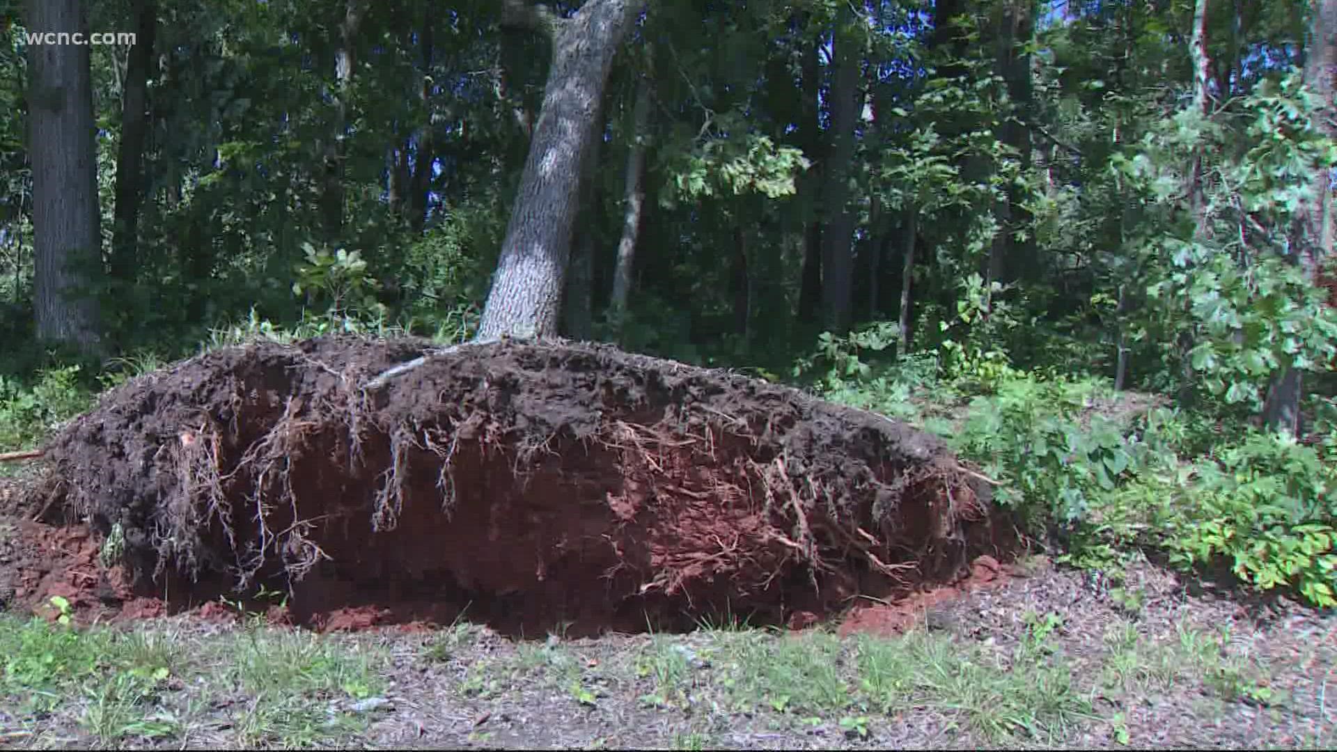
The team of meteorological investigators found damage from this storm associated with an EF-1 tornado. The tornado's peak winds reached 110 mph, investigators determined by looking at storm damage.
The tornado was on the ground for 5 miles, according to the National Weather Service.
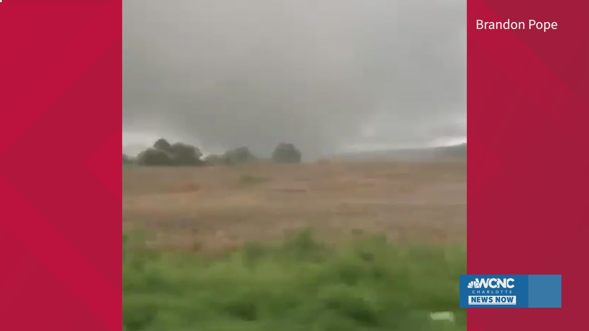
Brandon Pope shared video of the tornado with WCNC Charlotte:
The National Weather Service found the tornado began in Iredell County along Massey Deal Road just west of Old Mountain Road. The tornado traveled north-northwest crossing Miracle Farm Road and Linsey Farm Road before crossing into Alexander County. The tornado lifted near Lentx Road near Highway 64.
"Damage was almost entirely limited to uprooted hardwoods and snapped softwoods, with the most significant damage being a stand of pine trees on Waugh Farm Road that were snapped as high as 20 feet above the ground," the National Weather Service wrote in their findings Wednesday. "A couple of homes did receive very minor structural damage."
The National Weather Service office located in Greenville-Spartanburg, South Carolina, which has jurisdiction for Iredell and Alexander counties along with Mecklenburg County, issued 36 tornado warnings Tuesday. This is the most number of warnings issued by this NWS location since 1986.
Additional warnings were issued by adjacent National Weather Service offices.
"We want people to take tornado warnings seriously whenever they are issued," Trisha Palmer, the warning coordination meteorologist with the National Weather Service in Greenville-Spartanburg office told WCNC Charlotte's Chris Mulcahy Wednesday.
Palmer drove to Iredell and Alexander counties Wednesday to investigate the storm damage.
"It was induced by the tropical environment, they are hard to see," Palmer explained. "They are very hard to warn out because they spin up rapidly, they are very fast."
Storm investigators like Palmer will look at the direction storm damage falls to determine if the damage was caused by a tornado or thunderstorm winds. For example, when trees fall in the same direction, investigators will determine the damage was caused by straight-line winds from a severe thunderstorm. However, when trees fall in a variety of directions, the damage was caused by a tornado, which has winds circulating in all directions.
"I take the beginning point then I follow a path all the way to the ending point for the office to then make that measurement," Palmer told Mulcahy, who watched as Palmer did her investigation Wednesday.
"With a weaker tornado you are going to see the tree snapped near the top or you will just see the whole tree uprooted. Where as if you actually see the tree snapped towards the bottom, that's a slightly stronger tornado," Palmer explained.
An EF-1 tornado is one of 6 possible categorizations of a tornado:
- EF0...WEAK......65 TO 85 MPH
- EF1...WEAK......86 TO 110 MPH
- EF2...STRONG....111 TO 135 MPH
- EF3...STRONG....136 TO 165 MPH
- EF4...VIOLENT...166 TO 200 MPH
- EF5...VIOLENT...>200 MPH
The National Weather Service is conducting storm surveys across the Carolinas, including at locations of other possible tornadoes and at the sight of ongoing flooding across western North Carolina.