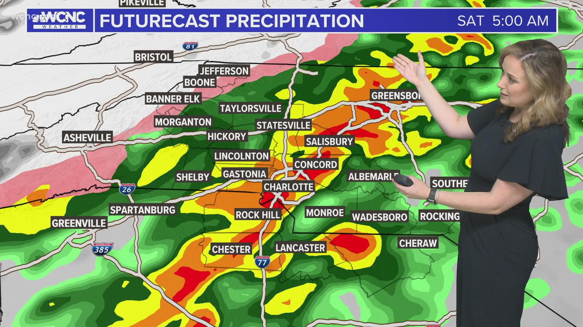
CHARLOTTE, N.C. — The Carolinas has a threat for severe weather late Friday night through Saturday morning.
The primary risks from these strong-to-severe storms are damaging wind gusts in excess of 60 mph, localized flooding from heavy pockets of rain, and isolated power outages due to windy conditions after the cold front.

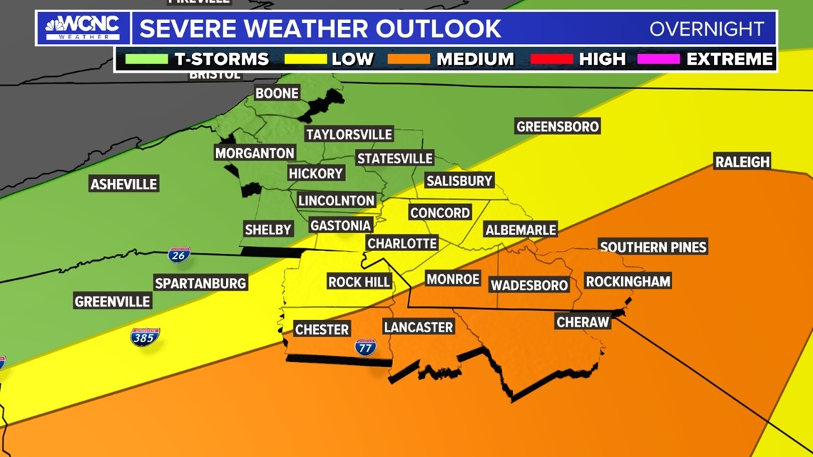
Location of storms
While some storms are possible in Charlotte, the areas most likely to experience strong storms are southeast of the Charlotte metro area. Towns like Chester, Lancaster, Wadesboro, Monroe, Cheraw and Rockingham are currently under a medium risk for seeing storms. Low-risk areas include Charlotte, Rock Hill, Albemarle, Concord, Salisbury, Gastonia, Shelby and Lincolnton.
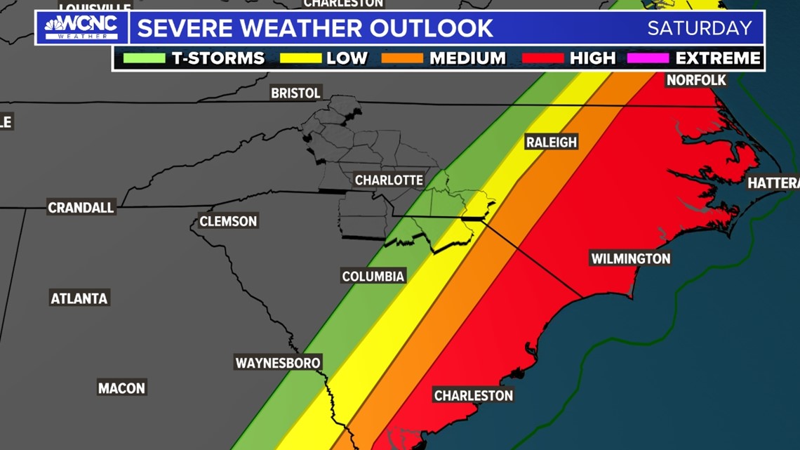
Eventually, the threat for strong-to-severe storms shifts east of our region. This will result in a high chance for severe weather along eastern parts of North and South Carolina.

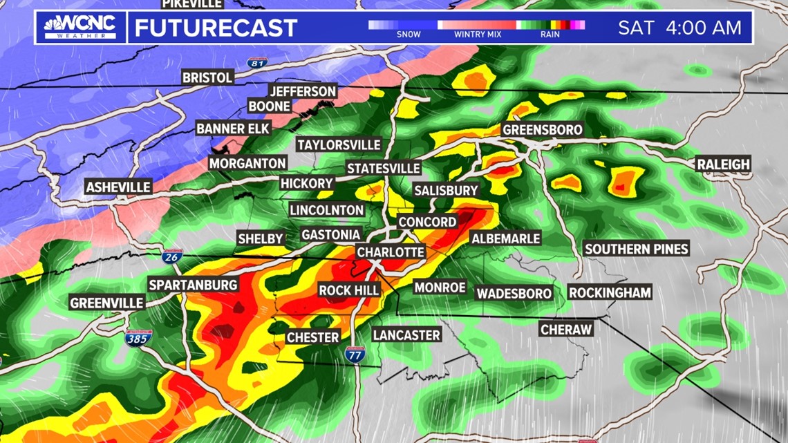
Timing of storms
Scattered showers will move through the Carolinas Friday afternoon and evening. Across the broader Charlotte metro area, storm chances increase around 2 a.m. and gradually become more widespread through Saturday morning.
Since the storms will occur when most people are sleeping, it is critical to have multiple ways to be awoken by weather alerts, including an NOAA weather radio and the WCNC Charlotte news app.

Rain and snow totals
The mountains and foothills will likely see half an inch or less of rain when all is said and done. Totals will peak between 0.5 of an inch to three-quarters for the northern piedmont and upwards of 1.0 inches along and south of Charlotte. Where downpours do set up, a few spots closer to 2 inches are possible, mainly southeast of the Queen City.
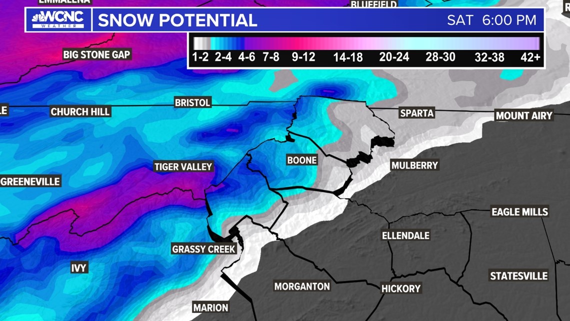
One of the reasons why the mountains and foothills won’t see much rain accumulation is cold air. Totals will be highest along the Tennessee border and the highest elevations where totals could range from 3 - 5 inches.
Lower elevations of Ashe, Watauga, and Avery counties will likely experience closer to 1 - 2 inches. A mix of rain and show could linger into portions of the foothills.

Wind chills
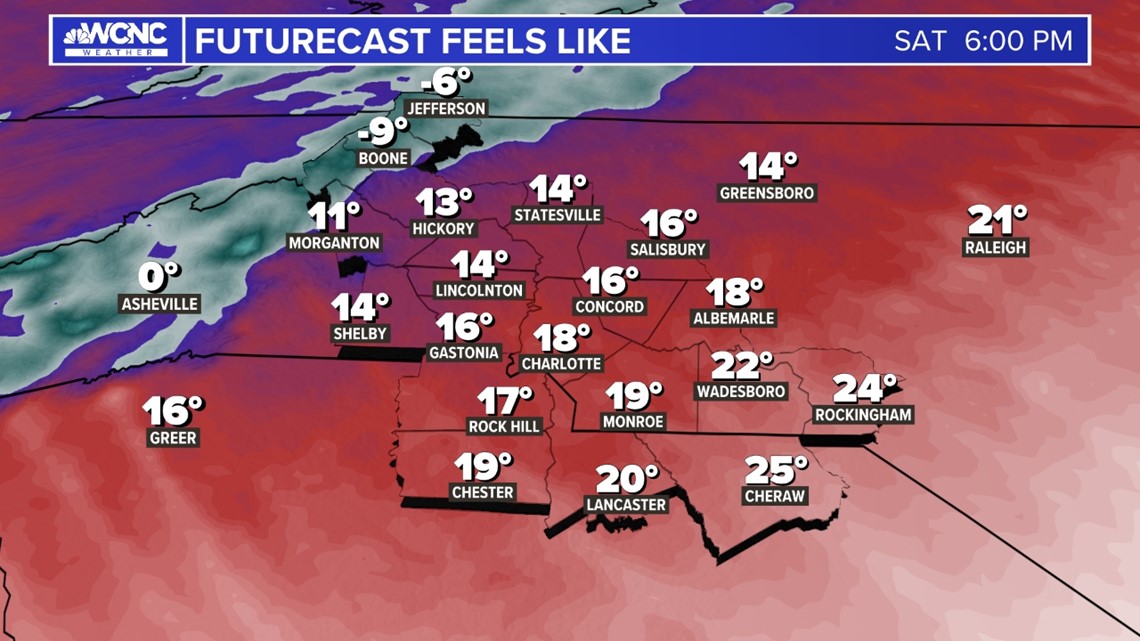
The severe storms are an indication of a passing cold front, which will plunge the Carolinas back into winter mode. Due to gusty wind, while the high temperature is in the 40s Saturday, the wind chill will stay below 40° all day long.
In the mountains, wind chills on Saturday will stay below 0° for much of the mid-late afternoon, evening, and overnight.

By Sunday morning, lows will plummet to the low 20s with wind chills in the teens. The freezing temperatures will threaten crops and gardens across the Carolinas.
Even in the afternoon Sunday, it’ll remain chilly, yet sunny, with highs peaking in the mid-50s.
Wind gusts
Wind gusts could surely lead to power outages in a few spots, especially in the mountains. Gusts could peak close to 50 mph Saturday afternoon.

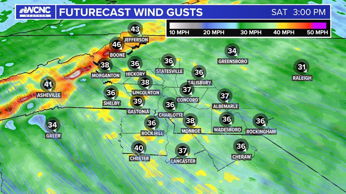
Across the Charlotte area, sustained winds will peak in the 20 - 25 mph range with gusts up to 40 mph. A Wind Advisory is in place for much of the region on Saturday.

