
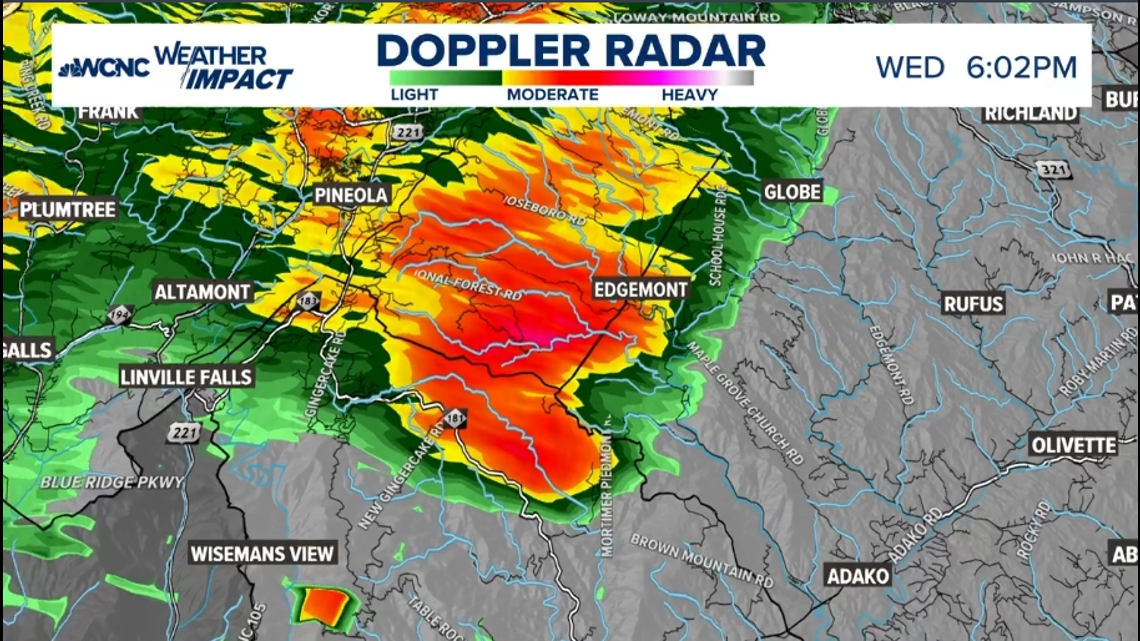
BURKE COUNTY, N.C. — Based on radar data, WCNC Weather Impact Chief Meteorologist Brad Panovich spotted a possible tornado in Burke County, North Carolina, Wednesday evening.
The same storm that had a confirmed tornado in Rutherford County moved into Burke County just before 6 p.m. which meant the conditions were conducive for severe weather there.
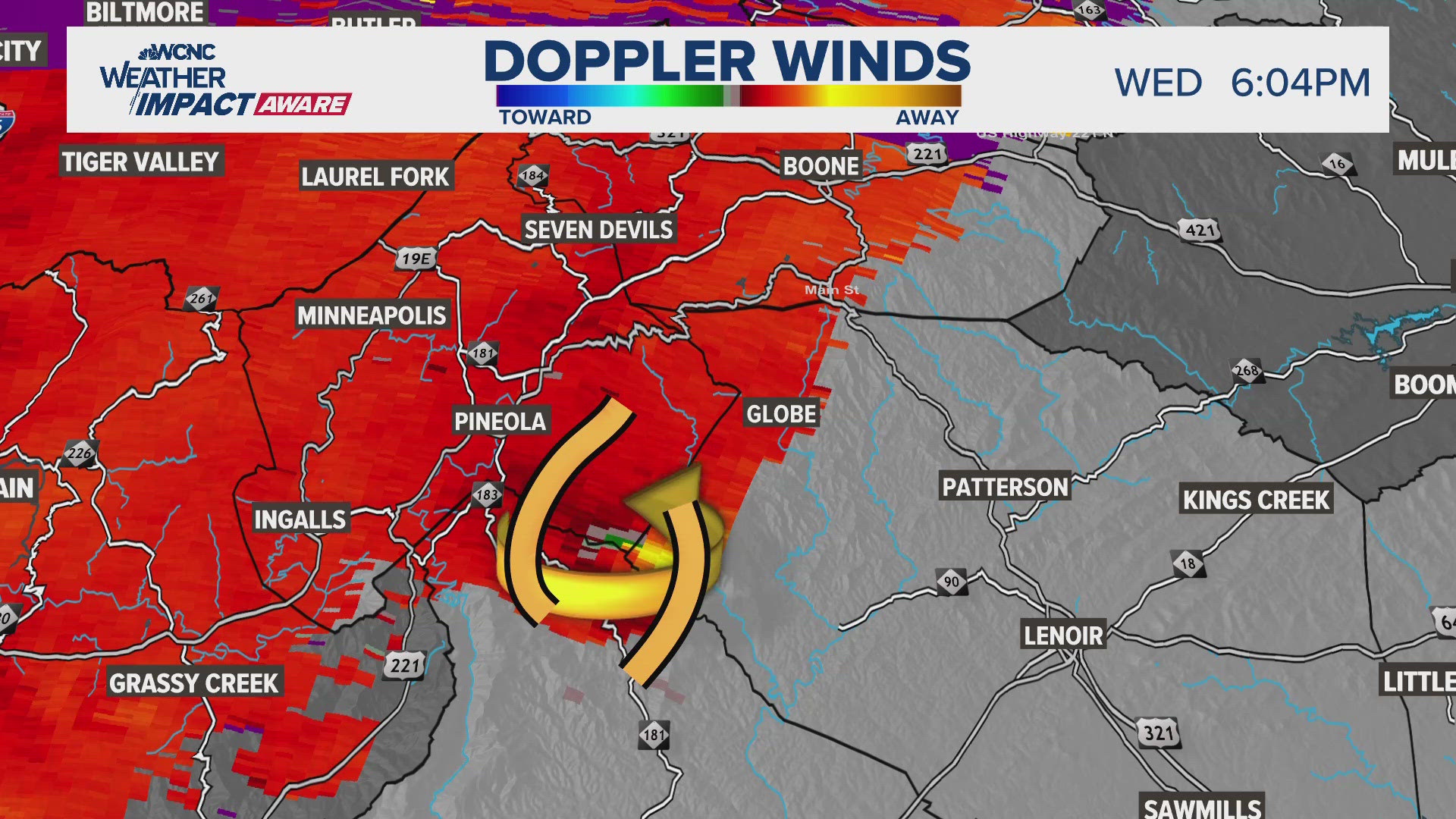
"Very high confidence that we have a tornado developing here in Burke County," Panovich said while live-tracking the storm in WCNC Charlotte's 6 p.m. news. "You don't see something that strong as often in the mountains, and the fact that the radar is showing this, and that we had ground truth from an actual video to the west, makes me think that we have a new tornado that touched down."


Panovich advised nearby people to seek shelter and if they knew someone in the area to warn them. The good news was it appeared in a sparsely populated area, but the risk is still there.
The same system moved into Edgemont, Globe and Boone afterward in Caldwell and Avery counties, just east of Grandfather Mountain, just after 6 p.m.

"Tornados can occur in the mountains as well," Panovich reminded everyone while tracking the storm "Definitely looks like some rotation in this storm."
This system isn't related to the oncoming Hurricane Helene, which is due to make landfall in Florida before heading toward the Carolinas in the overnight hours into Friday morning. However in the days leading up to Helene, it's important to stay Weather Aware as the risk for tornados and strong winds has increased.
Tropical storm watches and warnings are in place, including portions of our viewing area. A Tropical Storm Warning is in effect for Mecklenburg, Union, York, Chester, Gaston, Lincoln, Catawba, Cleveland, Burke, Caldwell and Avery counties. Impacted cities and towns include Banner Elk, Shelby, Lenoir, Morganton, Hickory, Newton, Gastonia, Charlotte, Rock Hill, Fort Mill, Chester, Lincolnton, Monroe, Huntersville, Matthews, and Cheraw.
A Tropical Storm Warning is issued with tropical-storm-force conditions are expected within a 36-hour period. In this case, our conditions will deteriorate Thursday afternoon and last through at least midday Friday.
Additionally, a Flood Watch is in place for Alexander, Catawba, Cleveland, Lincoln, Avery, Burke, Caldwell, Ashe, and Watauga counties. This is due to significant flooding possible for the mountains and foothills especially, where there's potential for five to ten inches of rain between now and Friday afternoon.
Closer to the Charlotte area, rainfall totals will range from three to six inches west of I-77 and around two to four inches east of the interstate.
Contact Brad Panovich at bpanovich@wcnc.com or follow him on Facebook, X and Instagram.