
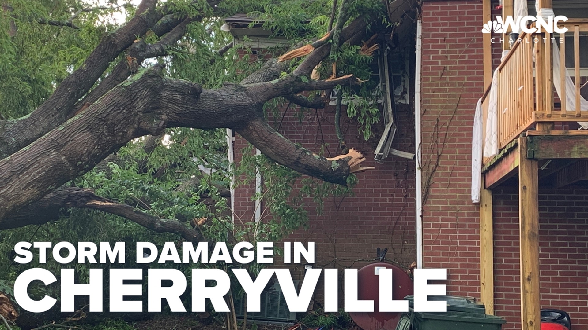
CHARLOTTE, N.C. — Officials in Cherryville declared a state of emergency after severe weather caused significant damage to the town Tuesday afternoon and evening.
The damage was caused Tuesday at 6:30 p.m. when a severe thunderstorm produced a microburst over the town, the National Weather Service found Wednesday after surveying the damage in-person.
RAISE YOUR WEATHER IQ: What is a microburst?
A microburst, also known as a downburst, is a small-but-might weather phenomenon that can cause damaging winds. Downbursts are the result of air that sinks rapidly to the surface. These “bursts” of air then hit the ground, which results in the spreading out of that area in a 360-degree direction.
The National Weather Service found Wednesday storm damage consistent with a microburst of winds upwards of 85 mph. The storm produced damaging winds over a two-mile width as it traveled 4.8 miles across the town.
In Carolina history, microburst wind speeds have been clocked as high as 175 mph near Morehead City, North Carolina. While microbursts are not tornadoes, they too can destroy entire buildings and are incredibly hard to predict.
At the time of the microburst Tuesday, the National Weather Service had issued a Severe Thunderstorm Warning denoting the storm was more intense than the typical thunderstorm. The warning from the weather service denoted the storm had the potential to produce "considerable" damage.
Cherryville Mayor H.L. Beam said Wednesday afternoon that over 100 personnel from agencies in surrounding counties and across North Carolina have assisted Cherryville crews with assessing damage, clearing debris and assisting residents in need of shelter after their homes were damaged.
Beam said Cherryville first responders were called to 97 incidents over a three-hour period Tuesday.
One person was injured when he tried "to help people trapped in a car, was thrown into the air as a tree fell, and suffered a laceration and a broken jaw," the National Weather Service wrote in their formal report of the incident. Beam added Wednesday that the man has since been released from the hospital.
"This was the closest thing to [Hurricane] Hugo that I have seen. Damage is everywhere, it's not just one single area," Beam said. "A lot of our neighborhoods have really been devastated by this and we are working as hard and as fast as we can."
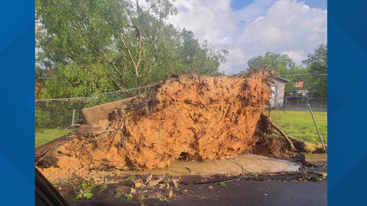
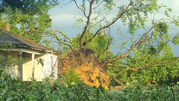
Initial assessments found at least 55 buildings were damaged during the storms. Beam said that number is expected to climb as crews cover more ground
A shelter is now open at Shady Grove Baptist Church in Cherryville to help residents who need a place to stay. Beam said 30 people were displaced by the storm. The Red Cross has assisted four of those people with shelter as of Wednesday afternoon. The Cherryville Police Department will be handing out 200 meals for residents in need of a hot meal, Beam said.
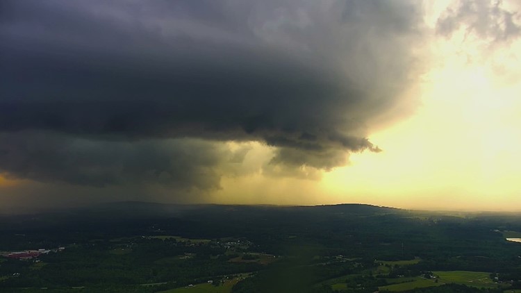
Gaston County supercell thunderstorm
The thunderstorm, which at the time had supercell-like characteristics, moved through the Gaston County community around 6:30 p.m.
RAISE YOUR WEATHER IQ: What is a supercell thunderstorm
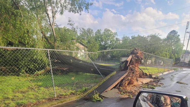
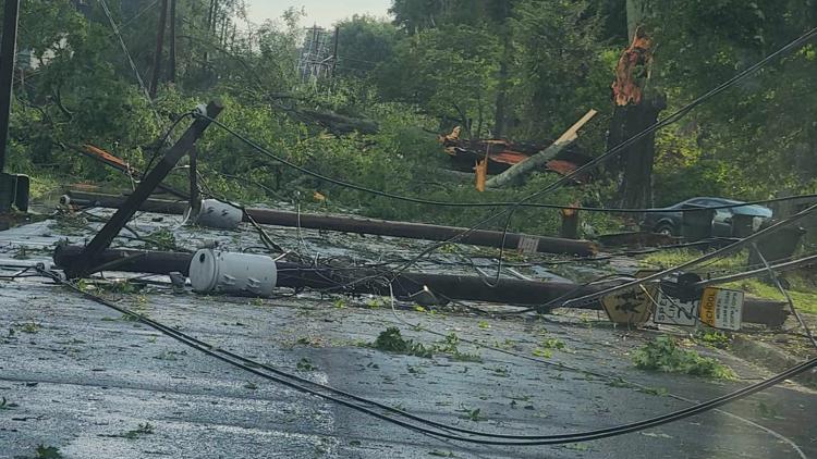
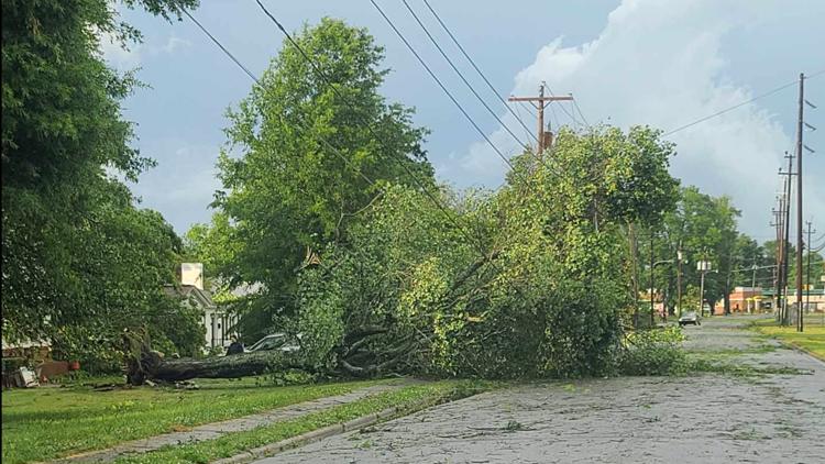
Photos shared by WCNC Charlotte viewers show the extent of the damage brought on by the storm, which also traveled across portions of McDowell, Cleveland, and Lincoln counties. The same cell would later prompt the severe thunderstorm warning over Charlotte around 7:30 p.m.
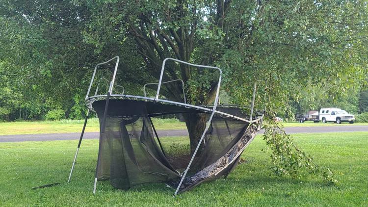
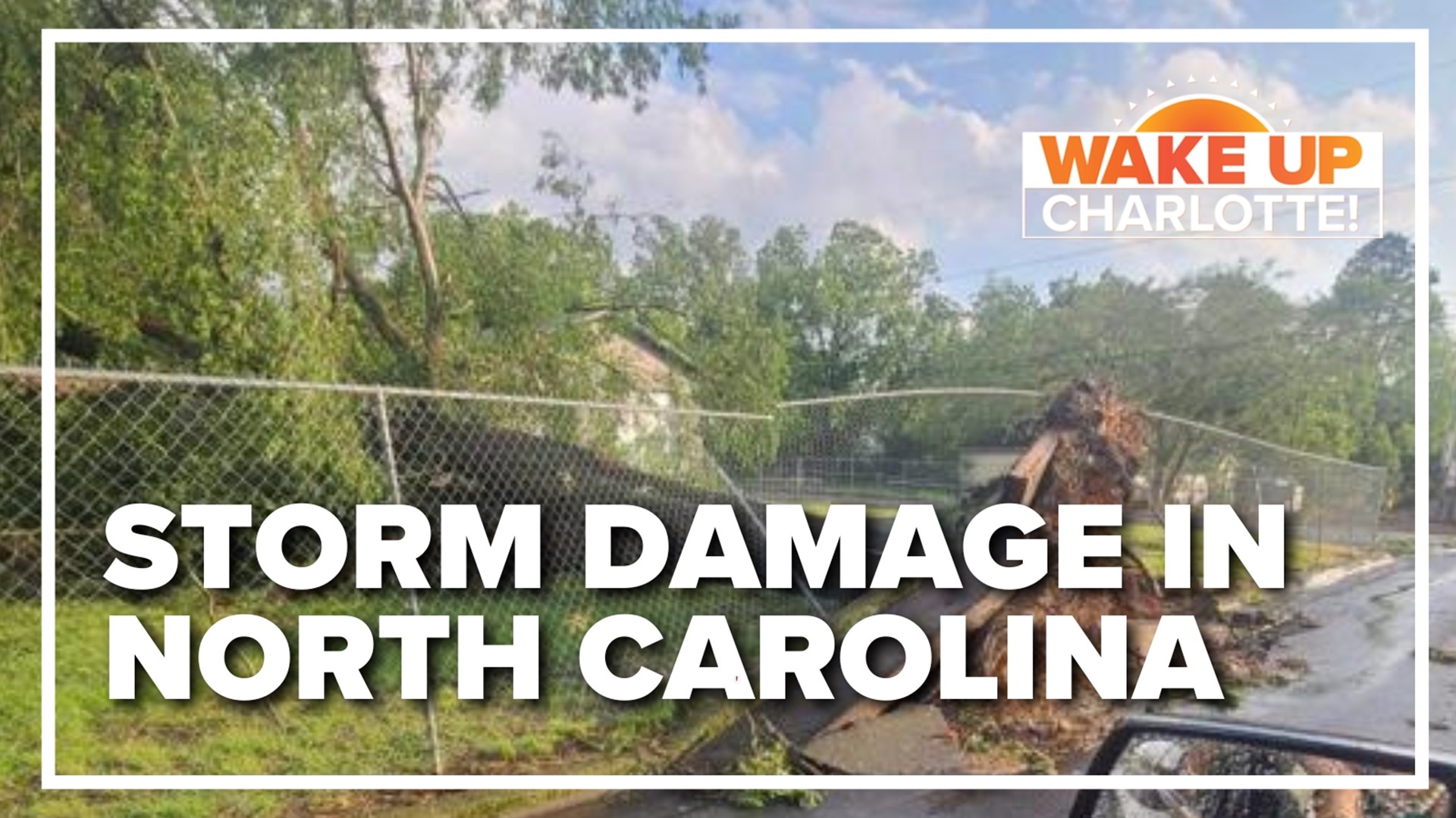
Storm damage in the Carolinas


If you safely capture photos or video of severe weather happening near you, you can send it to WCNC Charlotte. You can text us at 704-329-3600 or upload using the "Near Me" feature on the WCNC Charlotte mobile app.
RAISE YOUR WEATHER IQ: The 'tiers' of severe thunderstorm warnings
Meteorologist KJ Jacobs was streaming live on WCNC+, the station's free streaming channel, as the thunderstorm moved over the station's broadcast tower camera. The storm was captured by the WCNC Charlotte tower camera, which is mounted 1,450 feet above Dallas, North Carolina in Gaston County.
Cherryville school closures
The damage in Cherryville led to the closure of four schools Wednesday. Those schools would remain closed Thursday:
- Cherryville Elementary School
- W. Blane Beam Intermediate School
- John Chavis Middle School
- Cherryville High School
The school closings include the cancelation of school-related activities as well. On Thursday, Gaston County Schools confirmed classes would resume Friday.
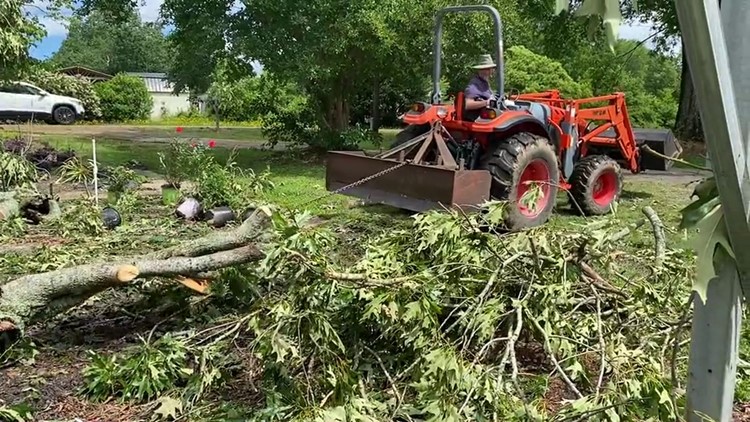
Cherryville storm clean up
In the aftermath of the storm, officials encouraged residents to stay inside. After daybreak Wednesday, efforts began to clean up from the storm damage.
What caused the Cherryville storm damage
Ahead of the official findings from the National Weather Service Wednesday evening, WCNC Charlotte Chief Meteorologist Brad Panovich uploaded a video to WCNC's Weather IQ YouTube video to give his analysis of the radar data from the storm.
More storm damage
Tuesday was a day to be Weather Aware in the Carolinas because of the threat of severe thunderstorms producing damaging wind and hail.
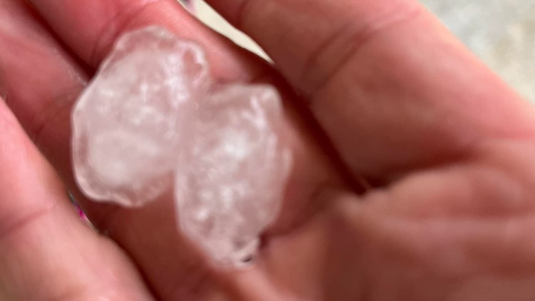
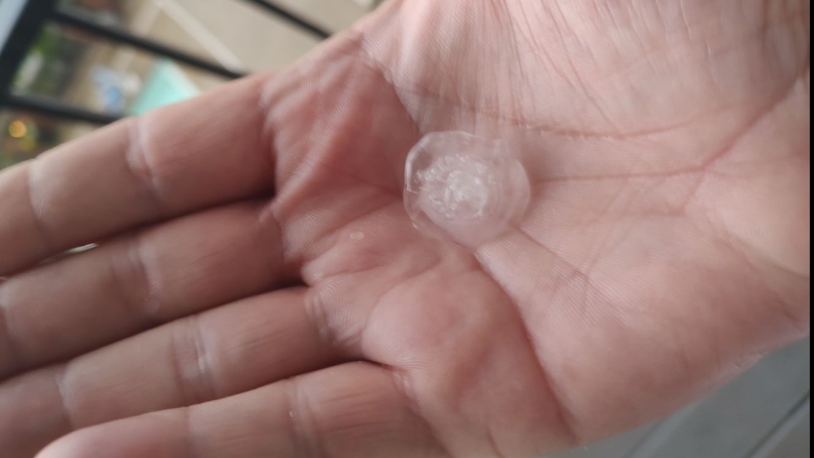
Elsewhere in the region, that same storm produced golf ball-sized hail of 1.75" of the Cleveland County town of Casar. The storm also brought down trees and powerlines in the Fero area of McDowell County.
The storm cell was losing strength as it finally arrived in Charlotte around 7:30 p.m. The storm still managed to produce hail in multiple locations, including on the Brookshire Freeway and also in the NoDa neighborhood north of Uptown Charlotte.

Plenty of storm fuel
WCNC Charlotte had advised communities to stay weather aware Tuesday because of the elevated severe weather risk.
"What's happening is warm, humid air is surging in below this cold front," Panovich explained ahead of the storms. "This is bringing the instability. This is the fuel for thunderstorms: hot, humid air at the surface."
Behind the fuel is the trigger for storms. That's the cold front. Panovich says this will push through and probably lead to some strong storms across the region.
RAISE YOUR WEATHER IQ: What is thunderstorm fuel
WCNC Charlotte updated viewers throughout the day on television and provided additional streaming updates on WCNC+, which can be streamed for free on the station's apps for phones, Roku, and Amazon Fire.