
CHARLOTTE, N.C. — To get snow in the Carolinas, you need equal parts of cold air and moisture with a favorable storm track. We have the El Nino storm track, bringing us lots of storms, and they have gotten us out of the drought already. But we have not seen much winter weather because of the lack of cold air.
That was until this week when the first significant arctic outbreak moved into the lower 48. This was well forecasted to occur a few weeks ago, but what we didn't know at the time was where the heart of the cold would go.
You see, when the polar jet stream dips south it brings the cold air. Well, this cold outbreak was centered in the middle of the country. The cold air dove straight south into Texas, leaving the Carolinas on the east side of the trough and actually pretty mild. So, the cold air was not in an ideal location.
Storm Tracks:
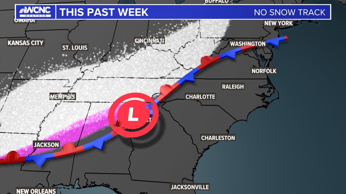
We didn't have the cold, but we also have not had the ideal storm track for snow yet, unless you are in the mountains. A few distinct storm tracks bring us winter weather in the Carolinas. This week so far, we have not had any of them.
This Week, no snow track:

For the latest weather alerts, download the WCNC Charlotte mobile app and enable push notifications.
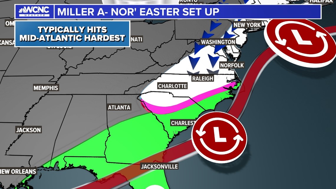
Best tracks for wintry weather:
The Miller-A storms track is the ideal snow track with cold air in place from the north. This is the Gulf Coast to East Coast nor'easter setup. As long as the cold air comes in first and is already in place when you get this track, we get our best snow chances around here.

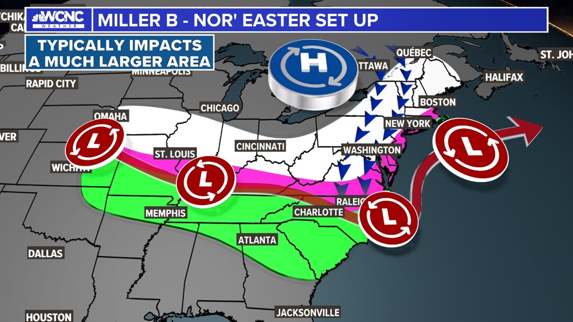
Track for a wintry mix:
The Miller-B storm track is a bit trickier. We usually have a weaker low-pressure system track across the Mid-South and reform near the coast and then become a nor'easter. This is usually our ice and wintry mix setup. This can bring snow as well, but usually, lesser amounts as the low and energy jump over the Piedmont to the coast.
These are by far the hardest to forecast due to all the uncertainty in the type of wintry precipitation and just how quickly the shift to the coast happens. This is also a major ice storm setup if the high pressure to the north stays very strong.

While we haven't had a great setup for snow we still have a long way to go. In the Charlotte area, February and early March are historically the snowiest times of the year, with March 2 actually being the snowiest single calendar in Charlotte.
Contact Brad Panovich at bpanovich@wcnc.com or follow him on Facebook, X and Instagram.
WCNC Charlotte’s Weather IQ YouTube channel gives detailed explainers from the WCNC Charlotte meteorologists to help you learn and understand weather, climate and science. Watch previous stories where you can raise your Weather IQ in the YouTube playlist below and subscribe to get updated when new videos are uploaded.