CHARLOTTE, N.C. — Even though we finally saw some snow and ice this winter we still are going to end up with above-average temperatures and below-average rainfall. Those trends were primarily a result of the La Nina pattern in the Pacific. All signs point to La Nina lasting through the spring before it wanes. So what will this mean for our spring weather? Let us take a look.
Temperatures and Rainfall:
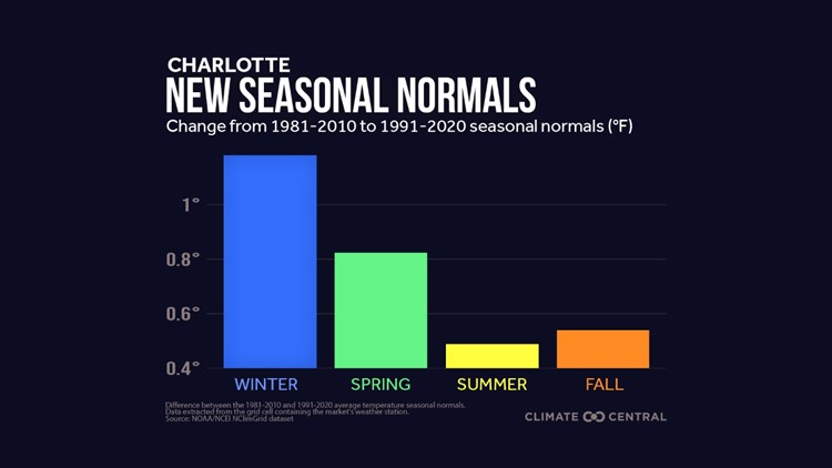
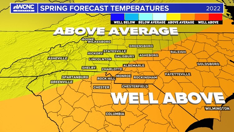
It's hard to find any reason we are going to see a colder pattern for the spring season. Now, this doesn't mean we won't have cold snaps, especially in March. It just means as the whole spring, March to May, will be warmer than the 30-year average of 1991-2020.
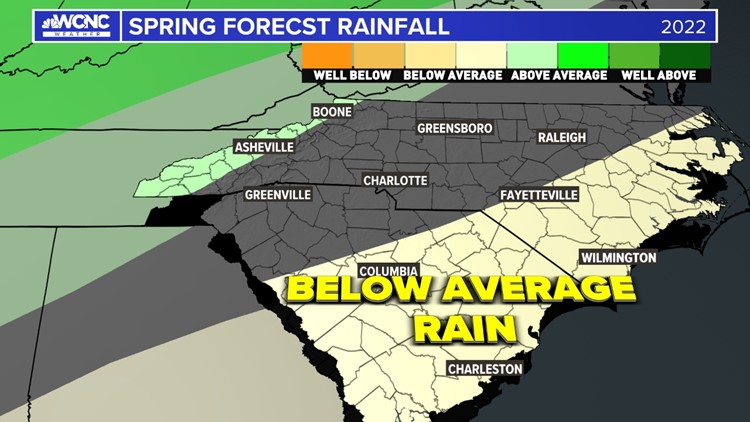
That warm and drier pattern will be driven primarily by the La Nina, which is still present in the equatorial Pacific ocean. This keeps the jetstream just to our north and allows for warmer air and more ridging over the southeastern U.S. So expect to see warmer temperatures and less rainfall. Just don't expect a drought, we should see something closer to average and enough to keep us from being in drought much longer.
Spring Forecast
Severe Weather:
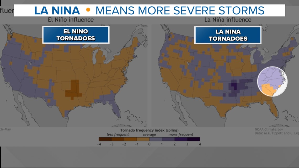
One thing about La Nina we know is that the risk for more severe storms is likely in the La Nina-influenced spring seasons. When you couple this with warmer-than-average water temperatures in the Gulf of Mexico which fuels more frequent severe storms in the South. Some of the largest severe weather outbreaks have occurred in the La Nina spring seasons in the past. So for this reason I expect a very active severe weather season this spring.


Pollen and Allergy season?
One of the downsides of warmer and drier weather is a long and more pronounced spring allergy season. Though that's to the cooler weather in January the leaf index is actually behind schedule for the middle of February.
This might not last long with a quick warm-up in March we usually see the pollen season take off. You then couple that with a warm and dry spring season and see fewer chances to wash out the pollen when it starts to peak in April.


