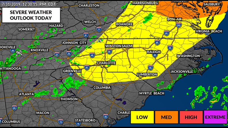
Strong-to-severe thunderstorms across the entire Charlotte area Wednesday have created a "low" risk of severe weather, according to First Warn Chief Meteorologist Brad Panovich.
Most of North Carolina has a chance of seeing the scattered afternoon and early evening storms.
One such storm in Ashe County Wednesday afternoon dropped golf ball size hail of 1.75" in Baldwin. There were no immediate reports of injuries or property damage.
Another severe thunderstorm brought one inch size hail to George Hildebrand School Road near Johnson Bridge Road in Burke County.
Additional storms are possible.
The National Weather Service may issue a Severe Thunderstorm Warning for a storm if the storm has the chance of producing 60 mph winds or at least 0.75" hail, or about the size of a quarter. Other thunderstorms may not be warned but could still contain a risk for heavy rain, localized flooding, and decreased visibility for drivers.
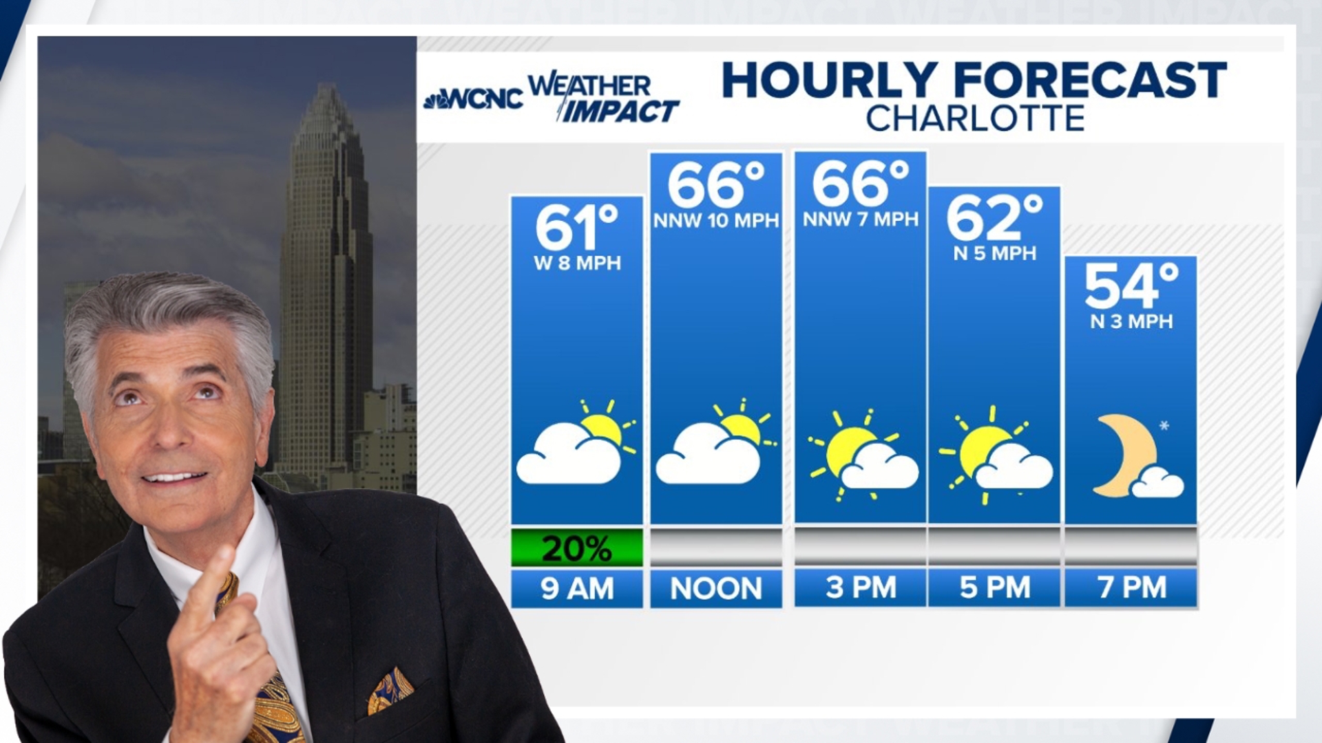
Additional scattered storms across the Charlotte area during the evening rush hour are possible.