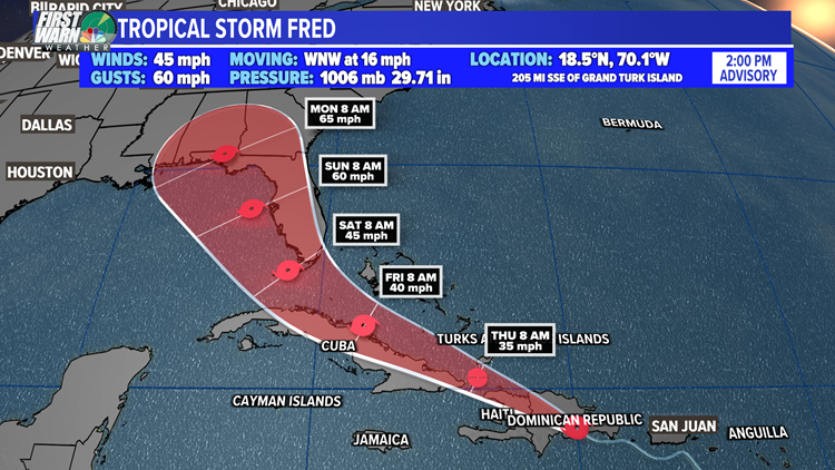
CHARLOTTE, N.C. — Tropical Storm Fred is currently moving over the Dominican Republic, about 30 miles west of Santo Domingo. The maximum sustained wind remains at 45 mph as of the 2 p.m. advisory Wednesday.
Although additional weakening is expected as Fred moves over the islands, the latest track from the National Hurricane Center shows the storm making it past the mountainous terrain. How strong it could eventually be will largely depend on that interaction with land, as well as wind shear.
The storm is expected to pass over Hispaniola this evening, near the Turks and Caicos Islands and the southeastern Bahamas on Thursday, and move near the northern coast of central Cuba on Friday.
Based on the latest National Hurricane Center track, impacts to Florida and the northern Gulf coast are expected this weekend and early next week.


A Tropical Storm Warning is in effect for the Dominican Republic on the south coast from Punta Palenque eastward, and on the north coast from the Dominican Republic/Haiti border eastward.
A Tropical Storm Watch is in effect for Haiti from the northern border with the Dominican Republic to Gonaives, Turks and Caicos Islands, the southeastern Bahamas, the Cuban provinces of Ciego de Avila, Camaguey, Las Tunas, Holguin, Granma, Santiago de Cuba, and Guantanamo.


Elsewhere in the tropics, a robust tropical wave is producing disorganized showers and storms as it slowly moves westward. Environmental conditions remain favorable for development as it continues this trek.
The system is expected to be near the Leeward Islands this weekend. A tropical depression or storm could form early next week. Right now, the NHC gives it a 50% chance of development over the next five days.
Something to watch closely, but nothing to worry about right now! The next storm name on the list is Grace.


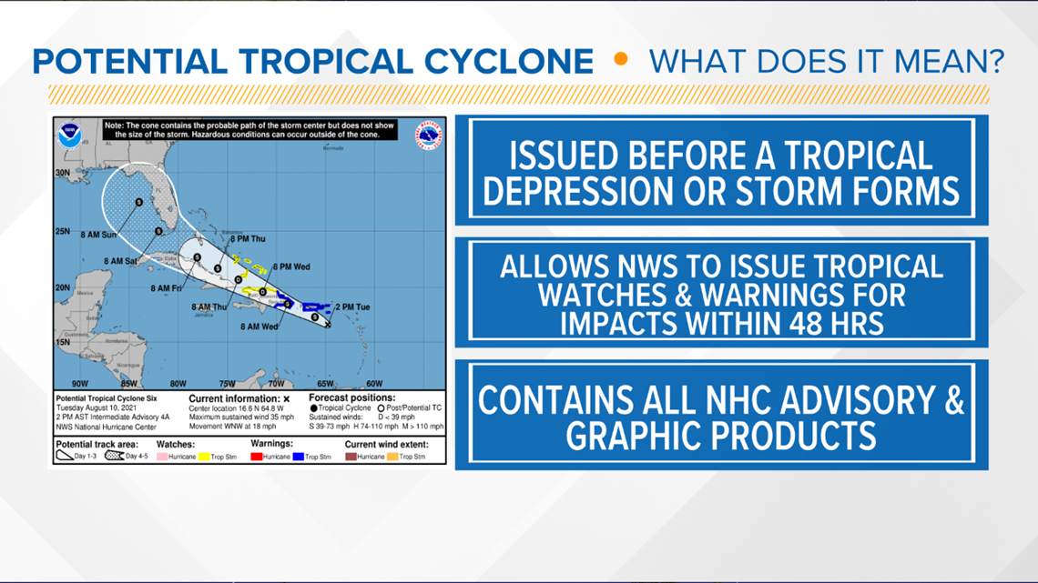
What is a Potential Tropical Cyclone?
The official definition from the National Hurricane Center is a disturbance that is not yet a tropical cyclone, but which poses the threat of bringing tropical storm or hurricane conditions to land areas within 48 hours.
This new label began a few years ago. Essentially, the NHC wanted a better way to warn people ahead of time about impacts from a tropical depression, tropical storm, or hurricane. This way, they can issue watches, warnings, and forecast tracks before a system "officially" forms.


