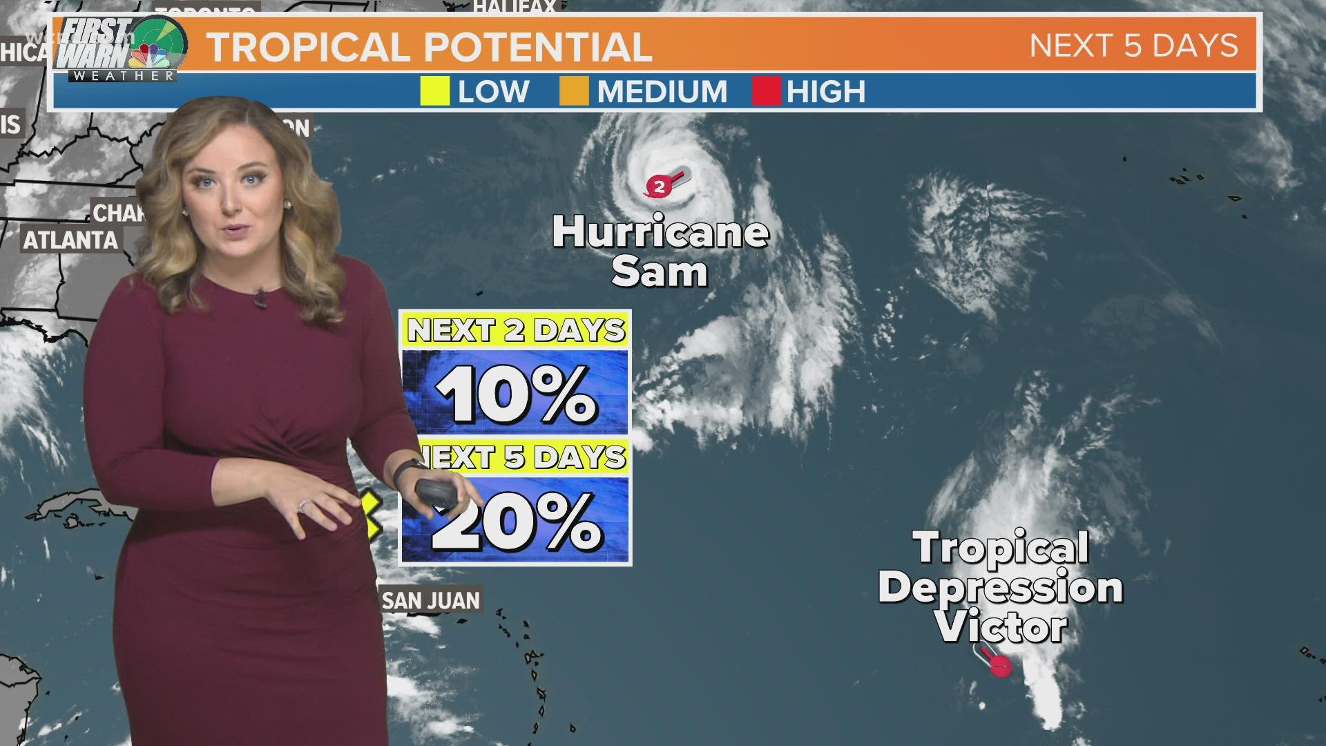
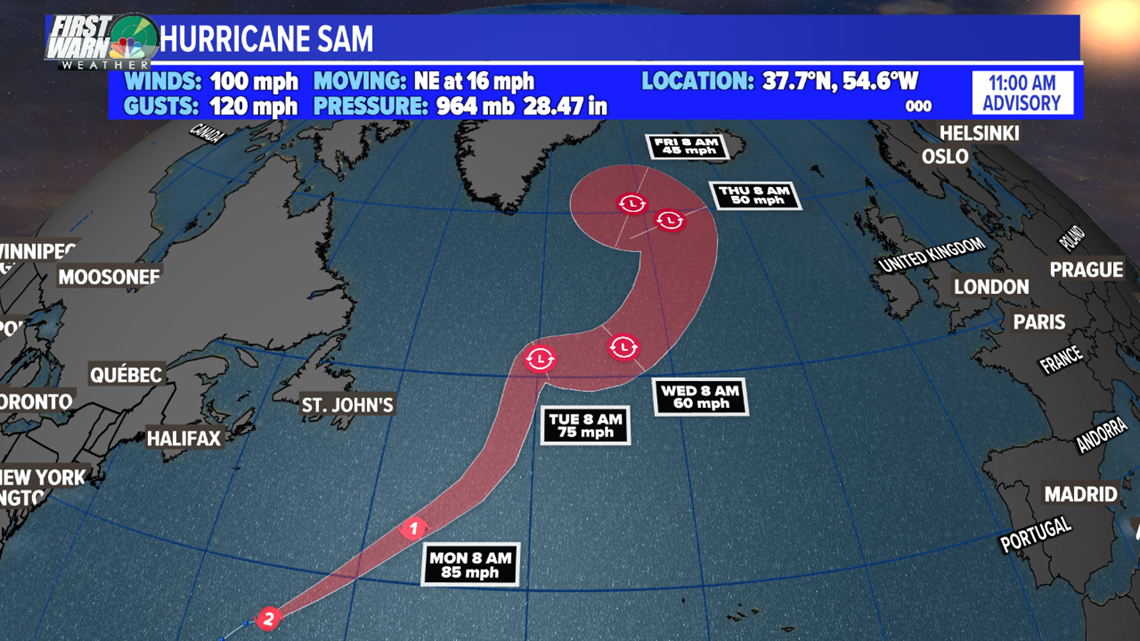
CHARLOTTE, N.C. — Hurricane Sam has lost its major hurricane status, now a Category 2 storm with maximum sustained winds of 100 mph. The center of Sam continues to move away from the United States.
This north-northeasterly track will eventually give way to a northerly movement, before it heads out to sea completely. Early this week, the storm is expected to weaken.

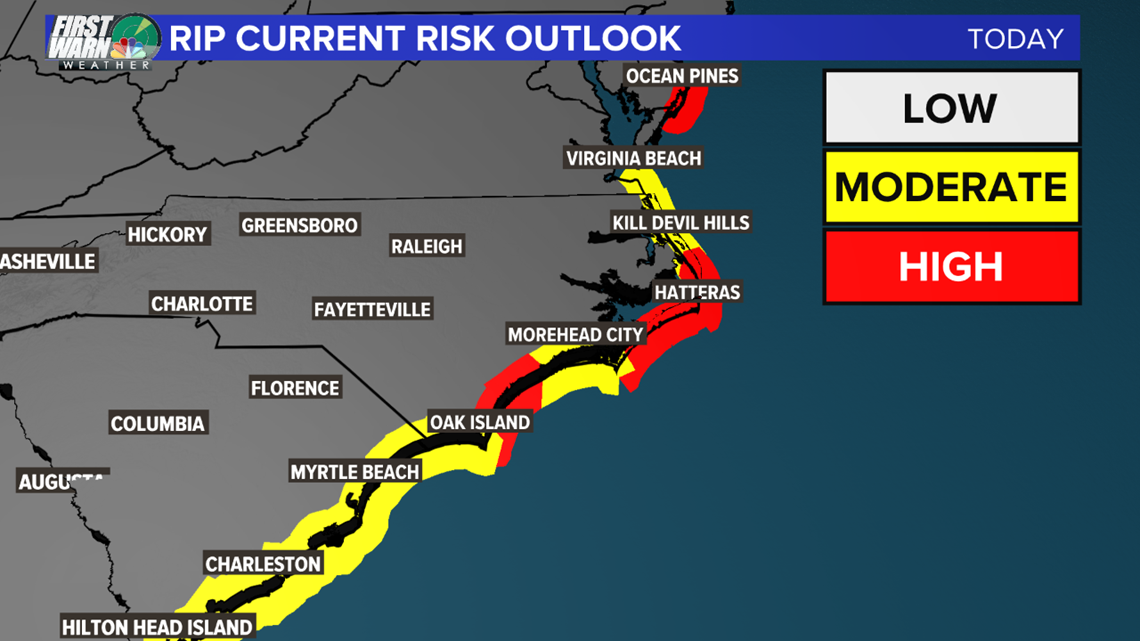
While Sam will not bring impacts locally, there is an elevated rip current risk along the Carolina coastline.
Moderate to high levels are expected, so please use caution if you plan to enjoy the last mostly dry day at the beach.

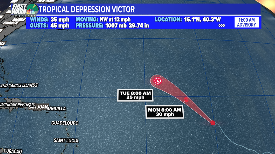
Victor has weakened to a tropical depression. High wind shear is expected to rip the storm apart by Monday. This is another classic "fish storm" that will only well up waters in the Atlantic and will not effect any land.
Victor was only the third time in history we had a name starting with the letter 'V'. The first was 2005 and the second was 2020.

Elsewhere, we do have a new tropical wave to monitor in the Atlantic Basin. There are two big reasons why this only has a 20% chance to develop. One is wind shear preventing organization.
Second, this low-pressure center is expected to move northwest toward the east coast this week. It'll bring a surge of tropical moisture for the Southeast as it interacts with a stalled front.
Eventually, the two look to merge as they dump multiple inches of rain for the Charlotte area this week. The rain looks to finally leave by next Sunday.
Ever since Hurricane Ida, all storms have formed out in the Atlantic and most have been short-lived. Larry and Sam were the 3rd and 4th major hurricanes of the season.

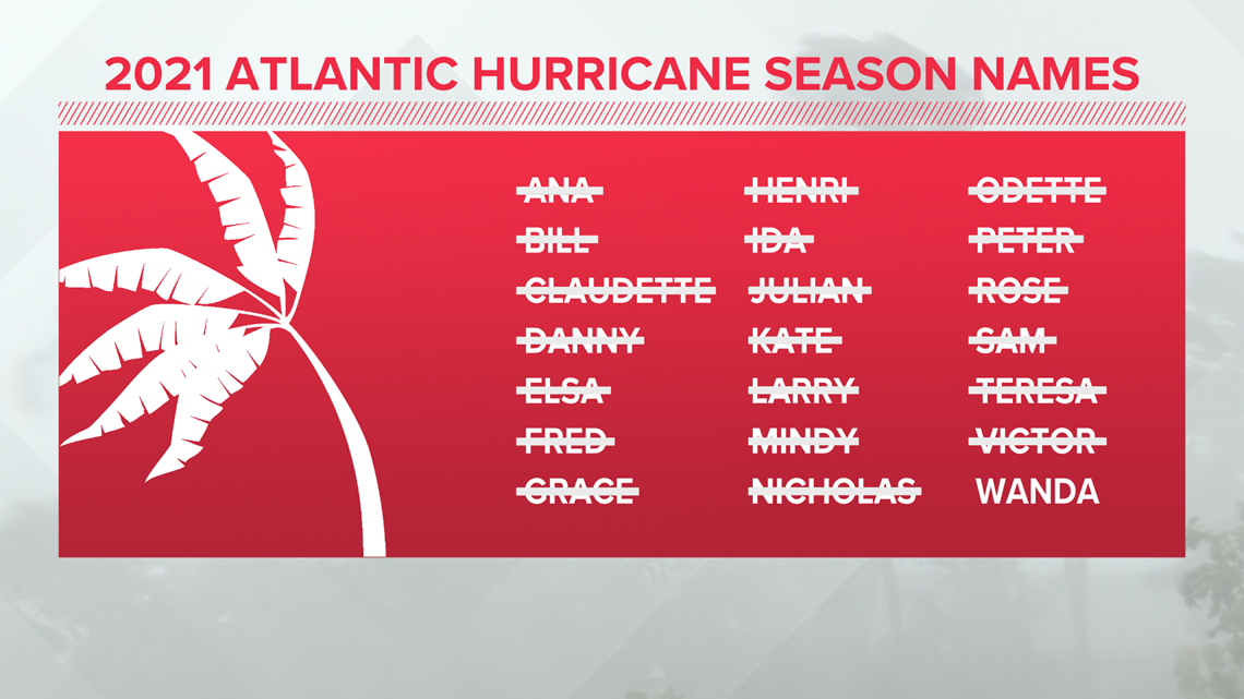
With only one name left, we'll most likely be into our supplemental storm list very soon.

