CHARLOTTE, N.C. — Extreme heat is the leading cause of weather-related deaths in the United States and it largely affects low-income communities.
A national heat mapping campaign is reviewing data from Charlotte and other cities to reduce heat-related illnesses.
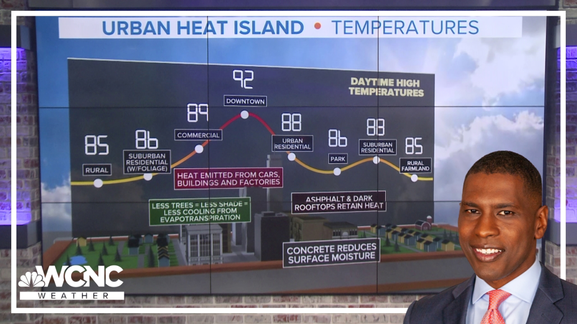
The urban heat island effect occurs when a city like Charlotte is significantly warmer than nearby rural areas. The temperature difference can be 15-to-20 degrees. A concentration of buildings, pavement, and other surfaces helps urban areas absorb and retain heat.
As the temperature rises and dangerous heat returns to the Carolinas this summer, a community-driven science initiative led by a team at the University of North Carolina at Charlotte recognizes the increasing effects of climate change.
“We have this legacy of disinvestment in communities of color and low-income communities in our city that manifest itself in poorer health conditions, lower quality of life outcomes for those communities," Katherine Idziorek, an assistant professor of geography and community planning at UNC Charlotte, said. "This will be an opportunity to understand better how heat impacts those disadvantaged communities and to spur action.”
Charlotte is one of 14 U.S. cities that will deploy heat mappers to collect data. The sensors will attach to cars.
“These sensors pick up both heat and humidity data, and they do so about six feet off the ground, which is meant to capture data in a way that will simulate how folks would experience moving about the city if you were a pedestrian or cyclist, "Idziorek said. "So this heat and humidity will be gathered every couple of seconds as mobile sensors are driven along a series of routes."
Idziorek said the data will be compiled into maps for city planners, policymakers, and emergency management. Raleigh and Durham were part of the heat watch campaign in 2021.
“Hoping to identify areas hotter than others, and this will help to inform actions where we might sight cooling centers, where we might prioritize planting more trees, where we might add additional bus shelters," Idziorek said. "There are a number of mitigation actions that can be taken to lessen the impact of urban heat."
Everyone will eventually have access to this data so they can use it to advocate for heat mitigation action and resources for their communities.
For the latest weather alerts, download the WCNC Charlotte mobile app and enable push notifications.
The effort will require some 80 to 100 volunteers on campaign day. Researchers anticipate the single-day collection will occur likely in July when temperatures are the hottest. Over three time periods in that single day - morning, afternoon, and evening - volunteers will travel 10 to 12 routes and collect real time data on temperature and humidity.
Here's a link to volunteer. Fill out our no-commitment interest form here
Contact KJ Jacobs at kjacobs3@wcnc.com and follow him on Facebook, X and Instagram.
WCNC Charlotte’s Weather IQ YouTube channel gives detailed explainers from the WCNC Charlotte weather meteorologists to help you learn and understand weather, climate and science. Watch previous stories where you can raise your Weather IQ in the YouTube playlist below and subscribe to get updated when new videos are uploaded.

