

CHARLOTTE, N.C. —
Weather Aware:
The heat continues to impact the Carolinas. Expect temperatures to top out near 95 Wednesday afternoon, but it will feel much with heat index values between 101 to 105 by early afternoon.
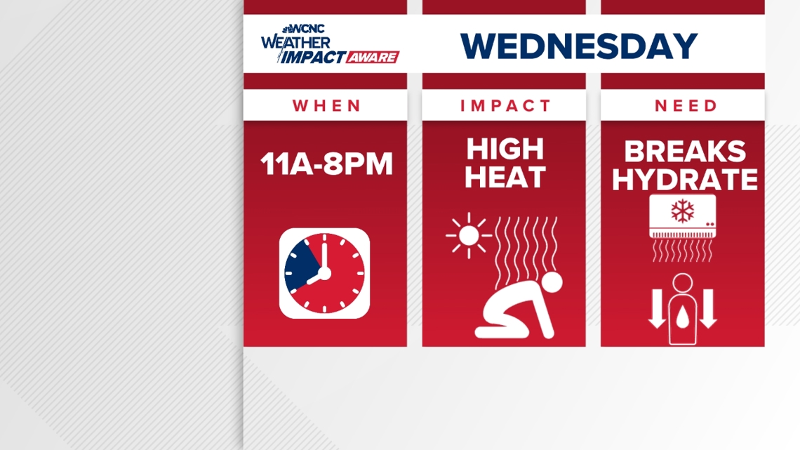
It's important to stay weather aware due to excessive by late morning and continue to take precautionary steps until around sunset. The peak heat will hit from 11 a.m. through 8 p.m. between now and Wednesday.

Rain chances are increasing into midweek, so any early afternoon shower will help bring temperatures down. The heat streak will come to an end by Thursday. A frontal system is approaching the Carolinas, and it's expected to provide more clouds and waves of showers and storms. The system will bring some relief from the dangerous heat as well as deliver that much needed rainfall.
The lack of widespread persistent rainfall is not helping the worsening drought across the Carolinas. Most of North Carolina is under a moderate drought with a few areas experiencing a severe drought.
It is important to stay weather aware and take necessary steps to beat the excessive heat during this period. The risk for high heat is classified as major, meaning oppressive heat and humidity levels could cause heat illnesses.
How to stay safe
When temperatures get this high in the Carolinas, it's important to stay Weather Aware by:
- Limiting your time outside/take breaks
- Staying hydrated
- Seeking shade when available
- Checking on the elderly and pets
Some relief is on the horizon after this streak of scorching hot temperatures. Temperatures are trending cooler than average starting Friday with daytime highs returning to the mid 80s. And the cool down could last for several days.
The only trade off will be higher rain chances, so cooler and wetter outlook after this heat wave.
WCNC Charlotte’s Weather IQ YouTube channel gives detailed explainers from the WCNC Weather Impact Team meteorologists to help you learn and understand weather, climate and science. Watch previous stories where you can raise your Weather IQ in the YouTube playlist below and subscribe to get updated when new videos are uploaded.