

CHARLOTTE, N.C. — After making landfall in South Carolina early Thursday, Debby was downgraded to a tropical depression just east of Charlotte. Still, the slow-moving tropical system impacted Charlotte and the rest of the Piedmont with unrelenting rainfall.
Numerous locations were inundated with flood waters, including area creeks and streams. The WCNC Charlotte Weather Impact Team is encouraging residents to remain Weather Aware as there could be localized flooding until water levels recede. The system cleared from the Charlotte area early Friday.
A large portion of the Charlotte area was under a Flash Flood Warning due to Debby's torrential rain through 5 p.m. Some of these were even upgraded to a Tier 2 Flash Flood Warning, which is the type of warning that will send an alert to your phone if you're in an affected area.
Power outages have mostly been restored but a few areas are still without electricity as of 7:30 a.m. Friday.
A Record Morning
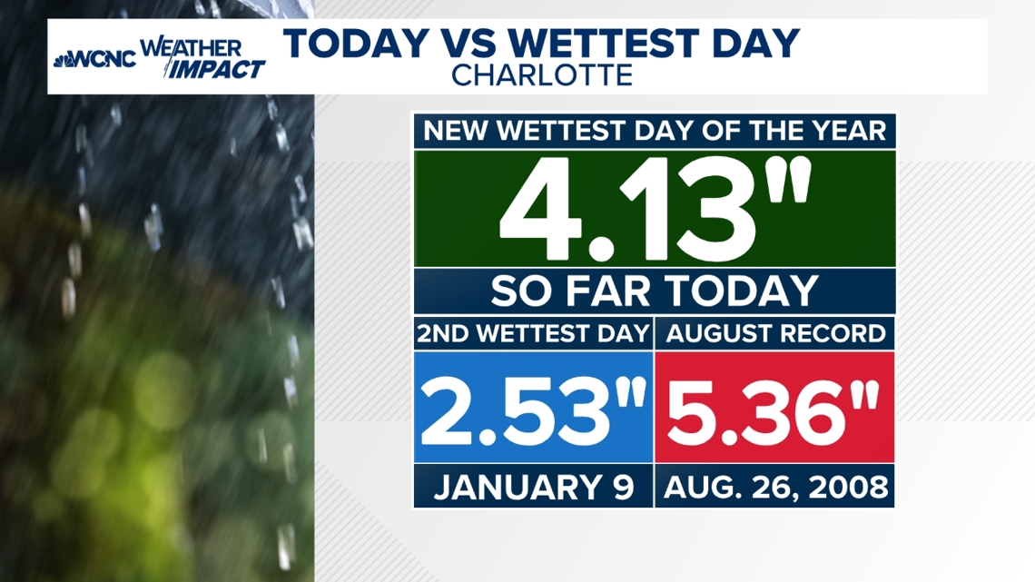
The rain was so heavy Charlotte broke the all-time rainfall record for Aug. 8 with 1.45 inches at 6 a.m. The record of 1.37 inches had stood since 1928. As of 9 a.m. Thursday, over 3 inches of rain had fallen, making this the wettest day of the year and catapulting it into one of the top five wettest days Charlotte has ever recorded during the month of August.
And the rainfall totals continued to climb with more than 4 inches by 5 p.m. making Thursday one of the top 20th wettest days in history for the Queen City.

When
Scattered light to moderate rain will continue this evening. Debby will slowly move to the north into Virginia tonight.

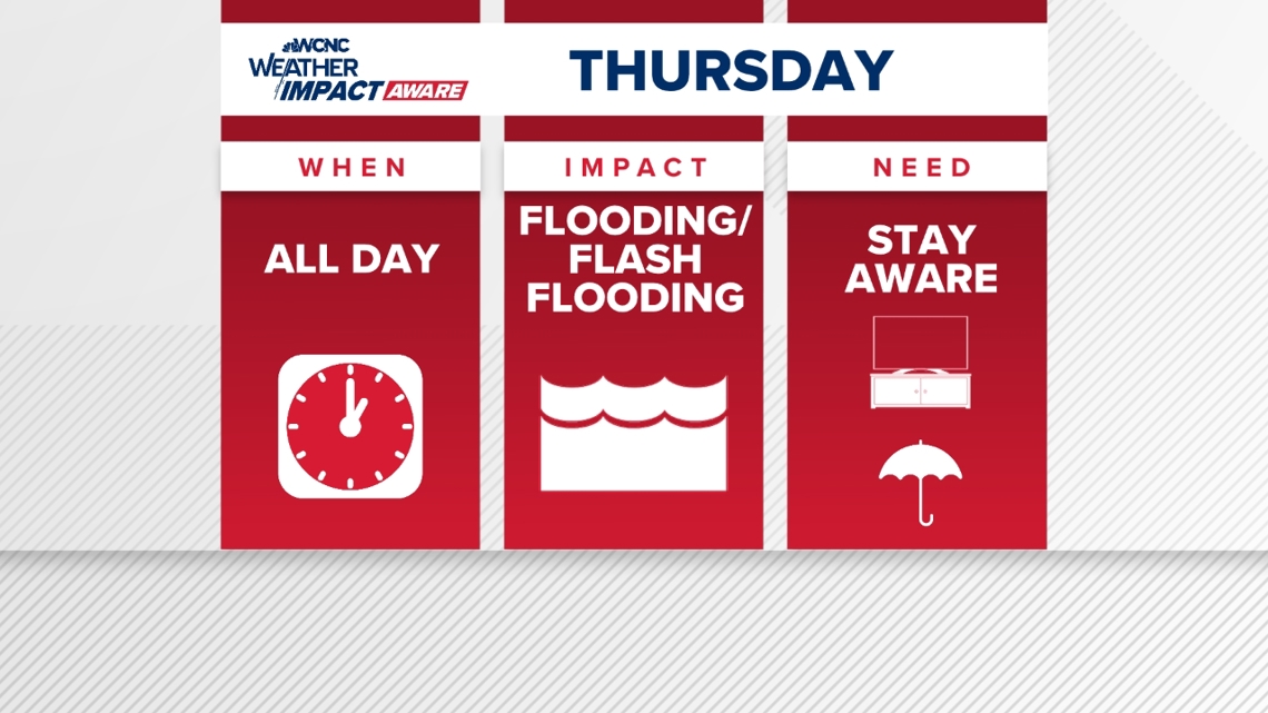
Impacts
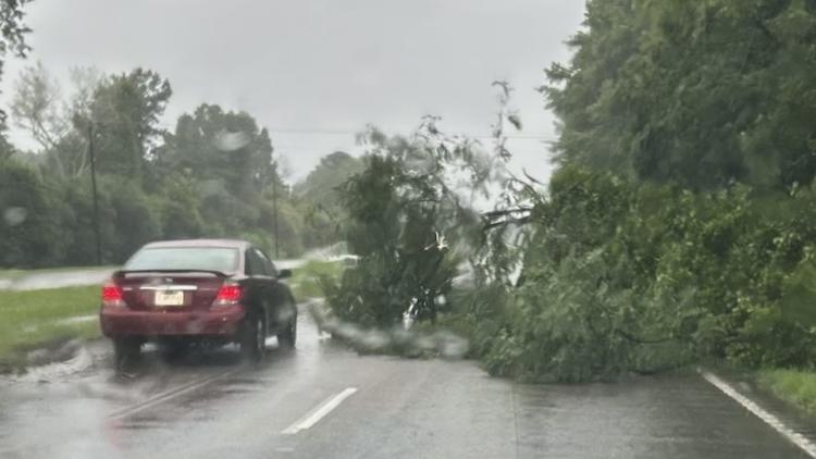
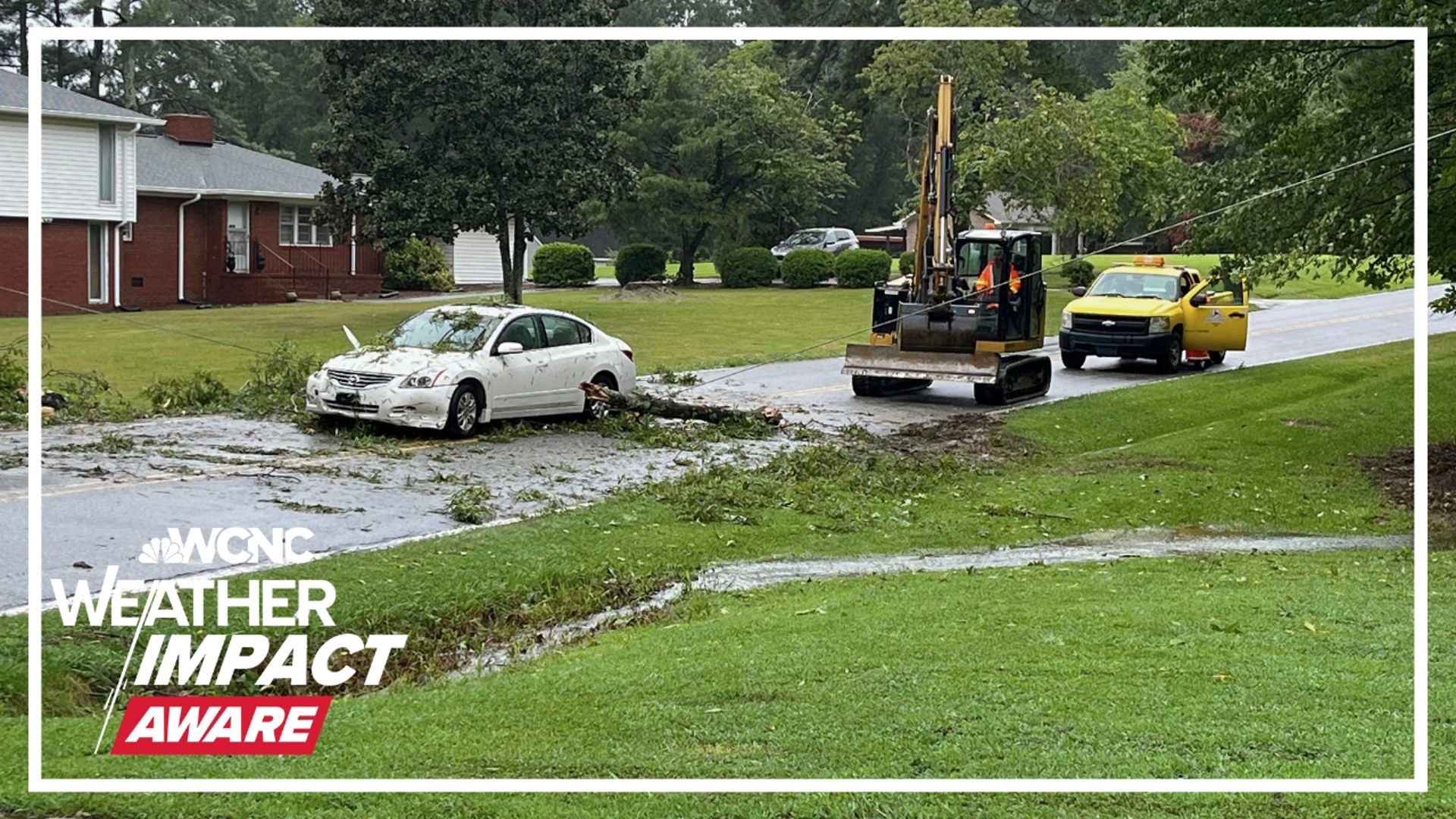
An onset of heavy rain early Thursday continued throughout much of day and caused numerous flood reports. Trees and power lines were impacted from saturated grounds and gusty winds. Watch for rising creek levels and be prepared to take action if these levels reach major flood stage.
What you need to do to stay safe
Panovich says everyone in the Carolinas should stay Weather Aware this week and keep a close eye on the rainfall totals. If you live in a flood-prone area, ensure you have the WCNC Charlotte app with weather notifications turned on so you will be alerted to weather emergencies in real time.
What you can do before the heavy rain moves in:
- Clean drains, gutters and downspouts to prevent clogs
- Mow your yard. You might not get another chance until Sunday
- Keep rain gear handy. Boots, jackets and umbrellas may be needed if you have to evacuate.
WCNC Charlotte To Go is a daily news and weather podcast you can listen to so you can start your day with news that impacts you from the team at WCNC Charlotte.
SUBSCRIBE: Apple Podcasts || Spotify || Pandora || TuneIn || Google Podcasts || iHeart
All of WCNC Charlotte's podcasts are free and available for both streaming and download. You can listen now on Android, iPhone, Amazon, and other internet-connected devices. Join us from North Carolina, South Carolina, or on the go anywhere.