CHARLOTTE, N.C. — When it comes to severe weather, it is helpful to know what to look out for when the skies turn dark. The more we know when it comes to severe weather, the safer we will be.
Here are 3 clouds you need to know about to help you be more weather aware.
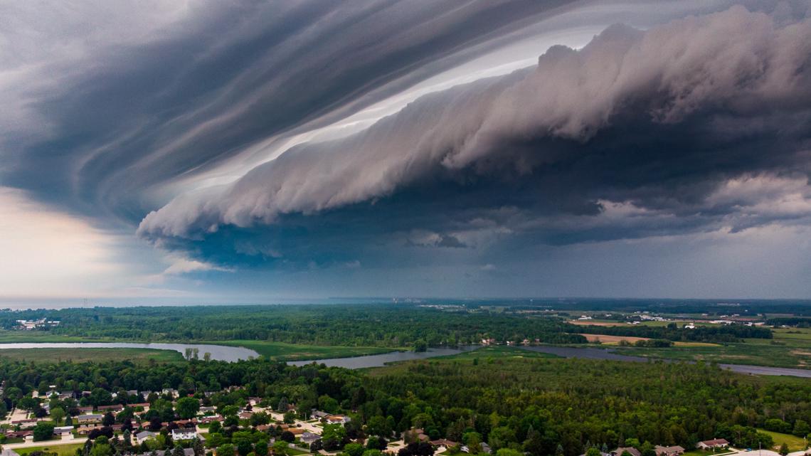
Shelf Cloud:
The shelf cloud is an impressive ominous thing to see. The cloud physically is the shelf on the leading edge of a line of storms. These are most common during the Summer months. This is where the outflow and the downdraft of a storm. Winds will increase as a shelf cloud pushes into your neighborhood now followed by rain.

Wall Cloud:
The wall cloud is your best identifier that a tornado is possible. This cloud is a compact, lowering of the cloud, where the updraft and inflow of a storm are located. There is a lot of movement here and when they are rotating wall clouds, funnel clouds and tornadoes can descend from them.

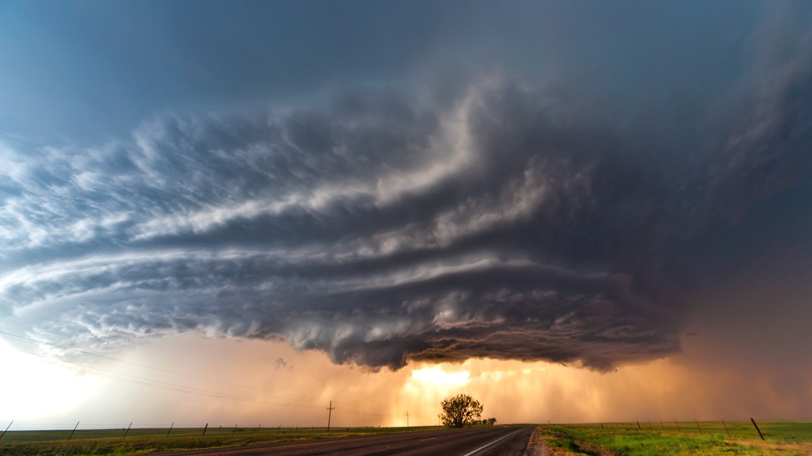
These are most commonly found on the south and southwest side of the storm. Brad caught one of these recently on our Dallas sky cams on April 6.
Mammatus Cloud:

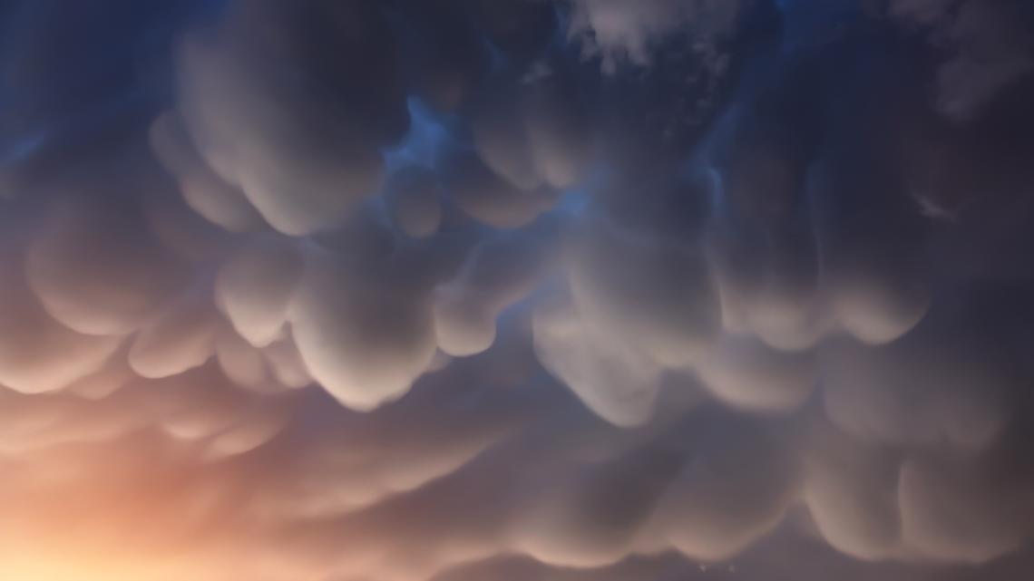
The mammatus cloud is a sign that a strong storm is very close. They look like little pouches hanging down from the cloud. Usually found in the anvil of severe thunderstorms. These clouds aren't threatening but for these to be produced, there is a lot of instability present.

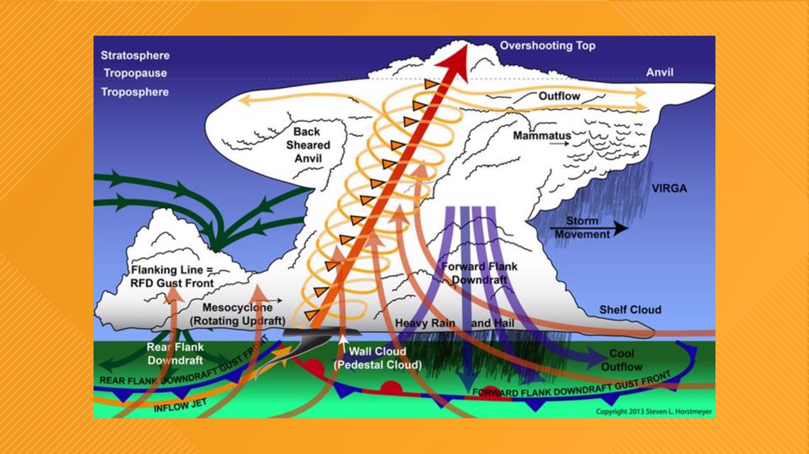
Looking at this supercell diagram above, mammatus are most prevalent on the leading edge of a storm's anvil but sometimes can appear on the backside of the storm after it passes.

