CHARLOTTE, N.C. —
Today
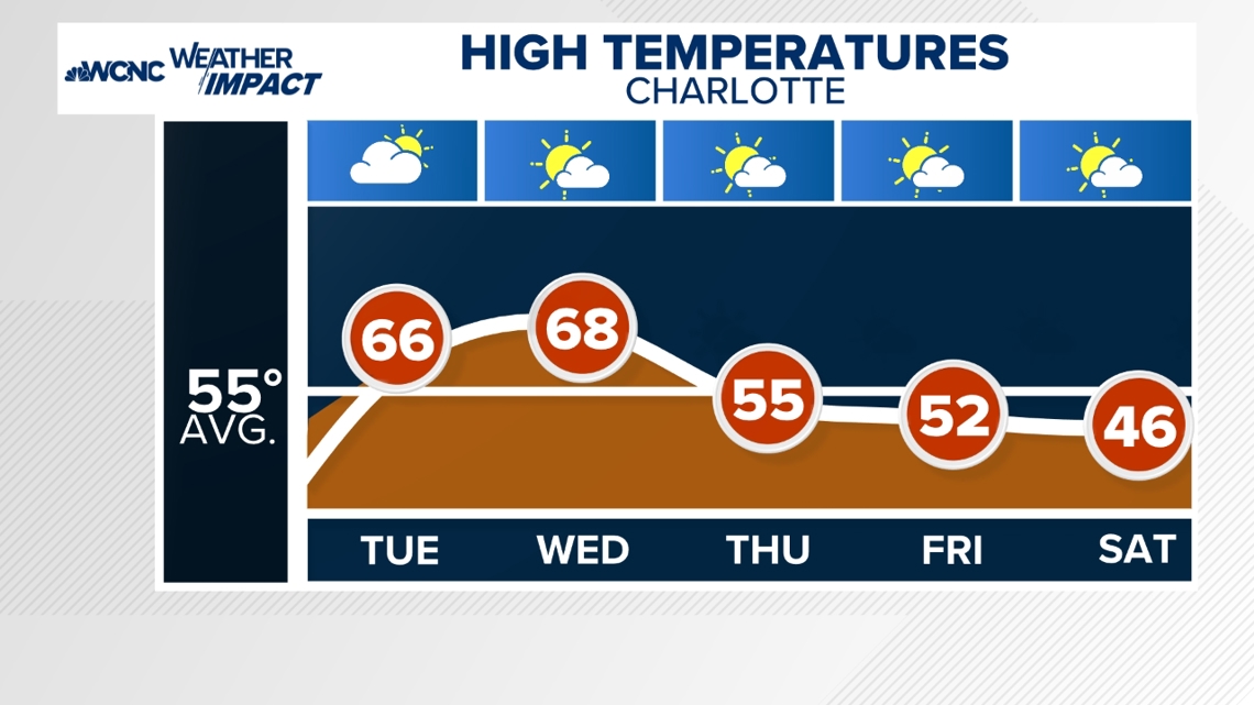
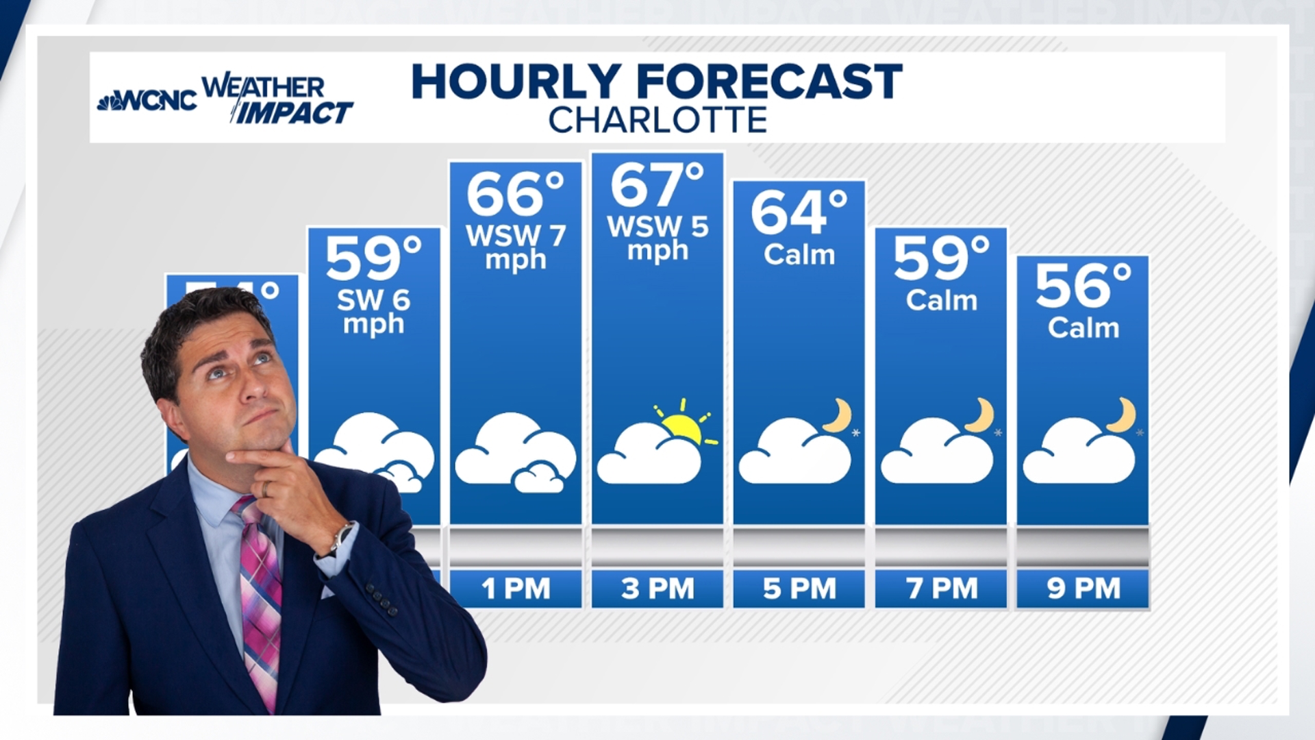
After the fog burned off, a mix of clouds and sunshine became the normal. More cloud cover will roll in later in the afternoon with a slight chance for a few passing light rain showers. High temperatures will be at least 10 degrees above average today in the mid-60s. Areas east and southeast will have highs in the upper 60s to low 70s. Overnight, lows will be mild due to clouds and fog. More dense fog will likely trigger another dense fog advisory for most of the area to start the day. Fog will be stubborn to erode again.
Wednesday
Dense fog starts the morning, making fog the hazard for the morning commute yet again.
This will be the warmest day of the week, with highs spiking to the upper 60s, possibly reaching the low 70s east and southeast of Charlotte. Later in the evening comes with another chance for scattered light rain showers (best chance up in the High Country). Temperatures overnight will fall into the upper 40s.
Rest of the Week
There is much cooler weather for the area on the front passes. Thursday and Friday will be in the low to mid-50s. A secondary cold front will pass, allowing for an even bigger cool down and some snow Friday into Saturday for the Mountains. Highs this weekend will drop back into the low to mid 40s.


Christmas Trends
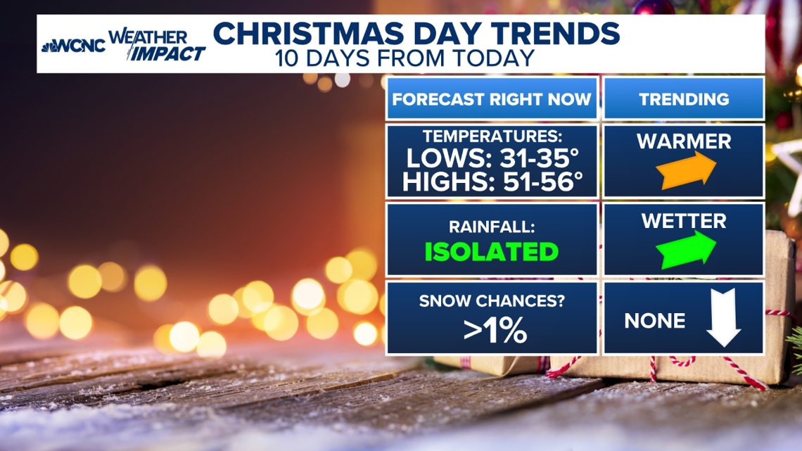
The forecast is trending toward cooler than average but clear conditions for Christmas Eve. However, isolated showers and more clouds may develop on Christmas Day, with lows in the low-mid 30s and highs in the mid-50s.


Stay connected to the WCNC Charlotte Weather Team:
Contact Brad Panovich at bpanovich@wcnc.com or follow him on Facebook, X and Instagram.
Contact Larry Sprinkle at lsprinkle@wcnc.com and follow him on Facebook, X and Instagram.
Contact Chris Mulcahy at cmulcahy@wcnc.com and follow him on Facebook, X, Instagram, and TikTok.
Contact Brittany Van Voorhees at bvanvoorhe@wcnc.com and follow her on Facebook, X and Instagram.
Contact Bekah Birdsall at rbirdsall@wcnc.com and follow her on Facebook, X and Instagram.

