CHARLOTTE, N.C. — A Winter Weather Advisory is in effect for Ashe, Watauga, Avery, Caldwell, Burke, and Alexander counties until 1 p.m. Saturday. This advisory brings the threat of freezing rain, sleet and snow into the mountains, foothills and northern piedmont.
WCNC Charlotte Chief Meteorologist Brad Panovich says there won't be much winter weather at all with this system. For the Charlotte area, we're only expected a very cold, miserable rain on Saturday.
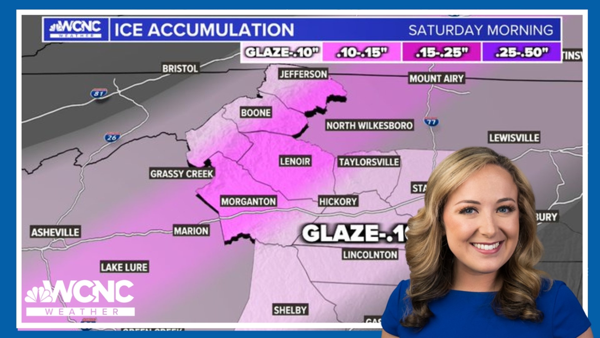
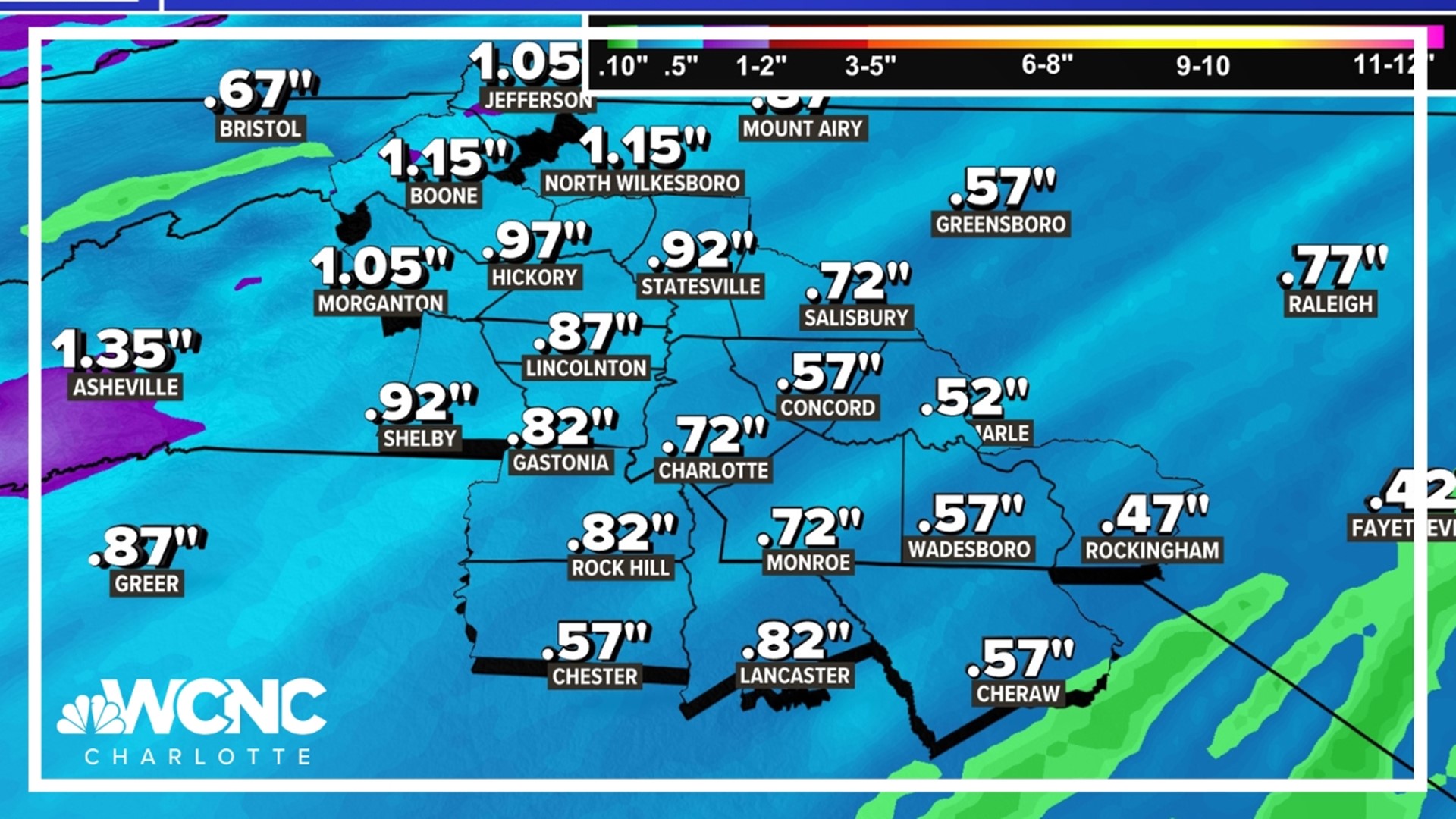
Panovich says the biggest risks with this system will be along Interstate 40 and northwest, with the potential for freezing rain, sleet and ice accumulations up to 0.1-0.15". Totals up to a quarter inch are not likely do to the temperatures being close to freezing.
Those areas include Asheville, Lake Lure, Morganton, McDowell County, Ashe County, Watauga County, Burke County, Caldwell County, Alexander County and Wilkes County. Charlotte could see a brief mixing or change over to sleet before sunrise. By mid to late morning there is even a chance for thunderstorms.
"There could be minor adjustments, but I will say overall, I expect this to be a minor event," Panovich said. "It's an inconvenient Saturday morning for travel in these areas for about a six- or seven-hour window. Other than that, we're not expecting any power outages, we're not expecting trees to come down and we're not expecting a huge, significant ice storm, snowstorm or anything like that."
RELATED: Brad Panovich's winter snow outlook
For the winter lovers out there, we get your frustration. Charlotte just recorded its first calendar year without even a trace of snow. That record dates back all the way to 1878. So if you love snow and wintry weather, you're probably getting antsy. So let's get to it.
Ice, ice baby
Panovich said the primary reason this won't be a big snow maker or winter storm is the lack of cold air. Panovich said that air is expected to move out quickly. Some of it will be trapped against the mountains, which is why the biggest ice risk is in the foothills, because the Charlotte area won't have enough cold air for anything besides rain.
"Early on Saturday we could see a quick glazing of ice but because the high pressure is gone, and now the winds are switching around to the southeast, we're going to see things warm up," Panovich said.
You also have to take into consideration that freezing rain warms the atmosphere. When you cool rain enough to make ice, that energy goes into the atmosphere, raising the temperature, Panovich explained. As a result, there's less cold air and the freezing rain transitions to regular rain.
"Right now the Boone area, I think it starts to snow, changes to ice, and yes, even rain," Panovich said. "Hickory, this is the area where we see ice the longest. So think Morganton, Lenoir, Taylorsville and into the Statesville area. It changes to rain for Gastonia and Charlotte and the surrounding areas. Around the Mecklenburg metro area, that's where we'll see a brief mix of ice in the morning and by 8 or 9 o'clock it changes to rain. For Monroe and Rock Hill, I think it's just solid rain."
A snowball's chance
Panovich says highways in the Charlotte area could be slick to start Saturday. Interstate 85 should be fine, but I-40 will probably be a little slick before getting better as temperatures rise, Panovich explained.
If you're looking for some snow, this storm system isn't going to do it. Maybe some flurries, but this is mostly ice.
"Boone may get a little bit of snow in there but mainly ice," Panovich said. "Even in the mountains, this is primarily going to be ice. This is not going to be a huge snow maker. The snow amounts aren't going to be anything to write home about because of the ice mixing in."
Because of the ice, Panovich says if you have any travel plans in the mountains, foothills or even northwest Piedmont, you should cancel or postpone until things improve.
Contact Brad Panovich at bpanovich@wcnc.com or follow him on Facebook, X and Instagram.


